VAN – CHAPTER VII – NEW MEXICO

November 19, 2024 from Los Osos, CA
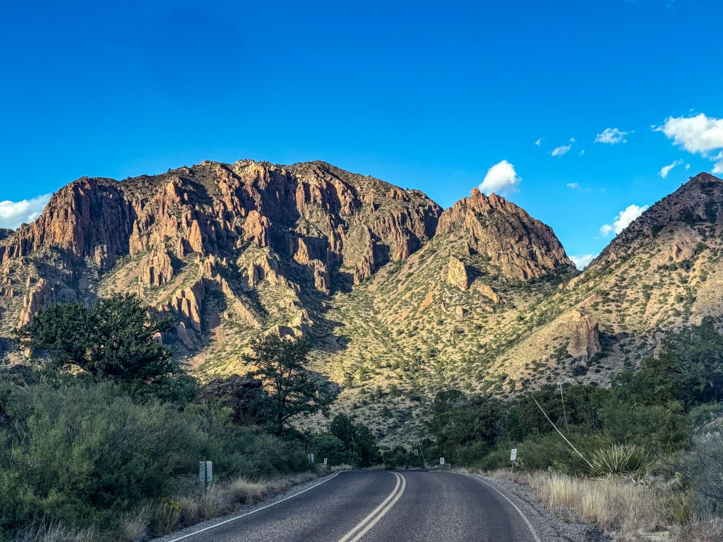
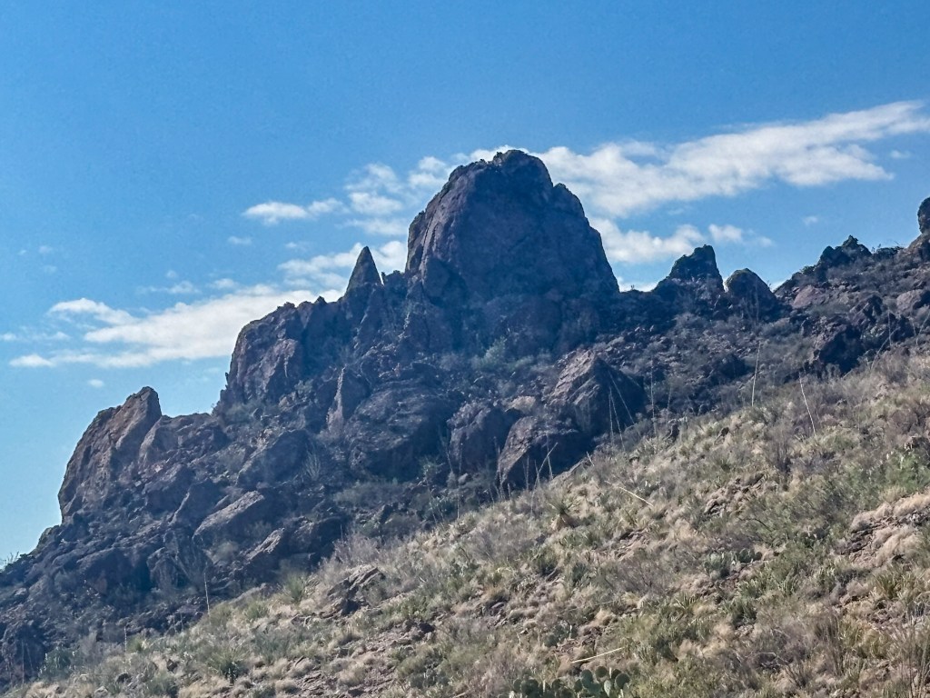
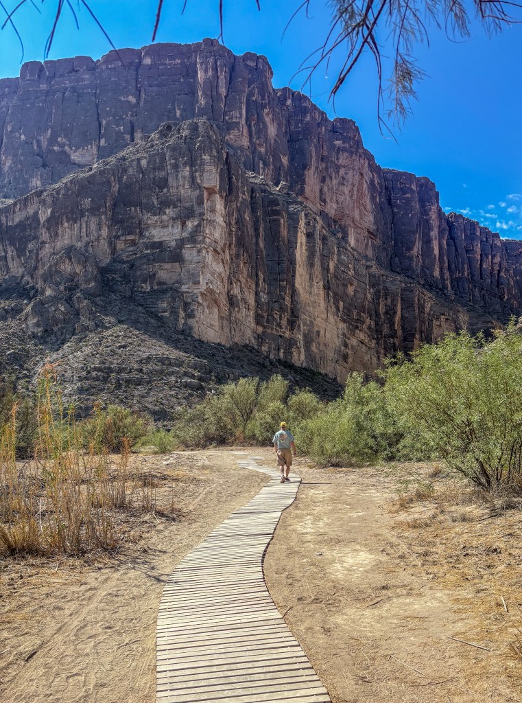
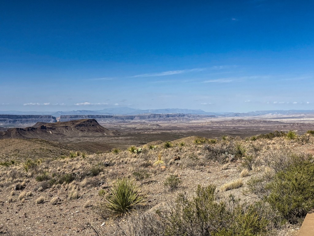
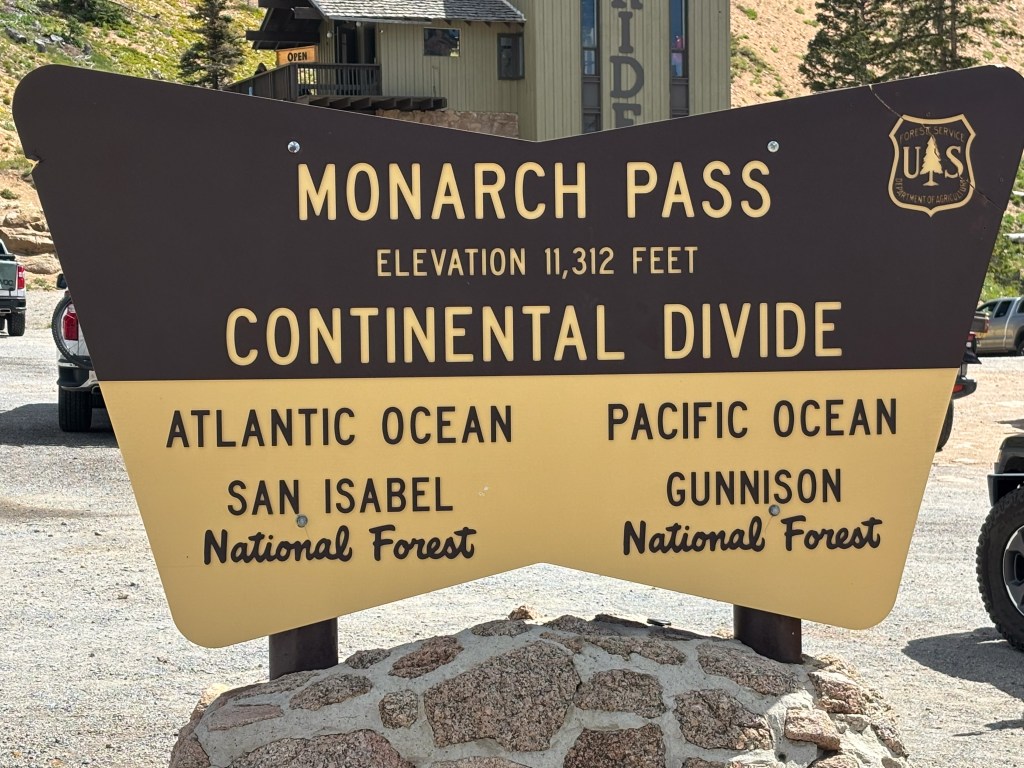
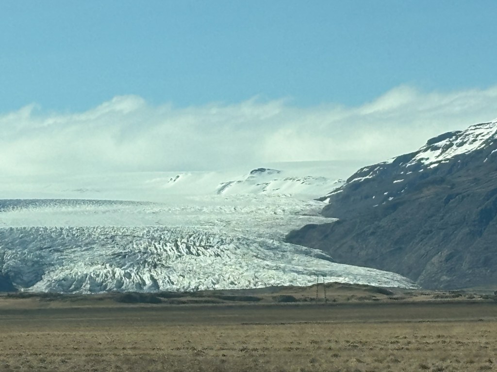
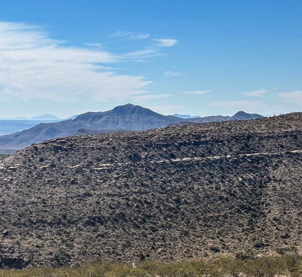
We’ve done quite a bit of “recalculating” for various reasons during this trip, and we’re still finding ourselves changing plans some. Our next 2 stops after Big Bend were Guadalupe Mountains National Park and Carlsbad Caverns. Because they are an easy drive from the city of Carlsbad, NM, we ended up with a welcome 4-night stay at another very nice KOA Campground there. The Caverns are in New Mexico, but are part of the Guadalupe Mountain range set on the Texas/New Mexico state line. The Visitor Center for Guadalupe is actually back in Texas, so that’s where we went our first day. This Park is a land of tall peaks and arid Chihuahuan Desert landscapes, with limited access by car (and a haven for serious hikers). It’s best known for its 8749’ Guadalupe Peak, the highest point in Texas (below, left, harder to photo from the road). Much closer to the road is the massive cliff face called El Capitan that has guided Native Americans, western explorers and settlers for centuries.

We really enjoyed the dioramas in the Visitor Center showing the biologically diverse canyons and the special wonder of the Guadalupes. The harshest of desert conditions prevail in the lowest elevations and driest canyons; at higher elevations a variety of grasses and woody plants dominate, including oaks, junipers, pinon, sumac and century plants. It was pretty fascinating.

The next day was one of our favorites on the trip—a visit to Carlsbad Caverns National Park, carved out of limestone and boasting the largest cave chamber in the world (larger than 6 football fields!) plus a network of caves that continue to be discovered…(135 passages so far). As mentioned in the handout at the Visitor Center, “Away from the sunlight, away from the flowering cactus, away from the songs of the desert birds and howl of the coyote lies the celebrated underground world of Carlsbad Cavern. It is an incomparable realm of gigantic subterranean chambers, fantastic cave formations and extraordinary features.”

We were a little nervous about taking an elevator down 725 feet (although it was certainly more appealing than walking a 1.25 mile switch-back cement path all the way down and back UP!). However, the ride was surprisingly easy and, after a few minutes of adjusting to the lower light level, we were pleased to follow a well-lit, cement sidewalk with sturdy brass handrails on both sides, wending its way through chambers of various sizes, each more astonishing than the one before. We did choose to walk the shorter self-guided 1.5 mile loop so we missed some of this 8.2 acre (!) Big Room, but most of the ceilings were 100+ feet high, so we never felt at all claustrophobic and everywhere we looked was amazing. See for yourself what we tried to capture with our camera/iPhones:

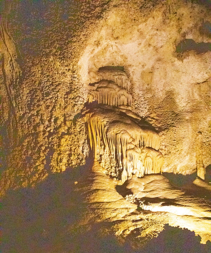
What we saw were a variety of stalagmites (up) and stalactites (down)—(I think of a mighty thumbs up to remember which is which)—together with formations called soda straws, draperies, flowstone, columns, lily pads, cave pearls, popcorn, etc., some quite small and some HUGE!!! It’s hard to briefly describe how all of this was formed, but basically it all began slowly over 500,000 years ago, after the cavern had formed—at a time when a wetter, cooler climate prevailed. Creation of each formation goes through a rather complicated chemical process that results in drops of calcite-laden water “depositing its tiny mineral load as a crystal of calcite. Billions and Billions of drops later, thousands of cave formations had taken shape.” The popcorn was formed differently, where water evaporated and left behind aragonite—similar to calcite but with a different crystal structure. All of it was absolutely jaw-dropping amazing!

It was nice to have some extra days in Carlsbad to relax and catch up on such things as laundry, emails and blog-writing. We’re still a bit slow in posting, but eventually we’ll get them all done. Writing blogs is easy, but the rest is way more time-consuming than we anticipate, especially since we try to edit and choose the best photos possible to go along with our words.  Then it’s a 4-step process to export and import these photos to Word Press. Thanks again for your patience.

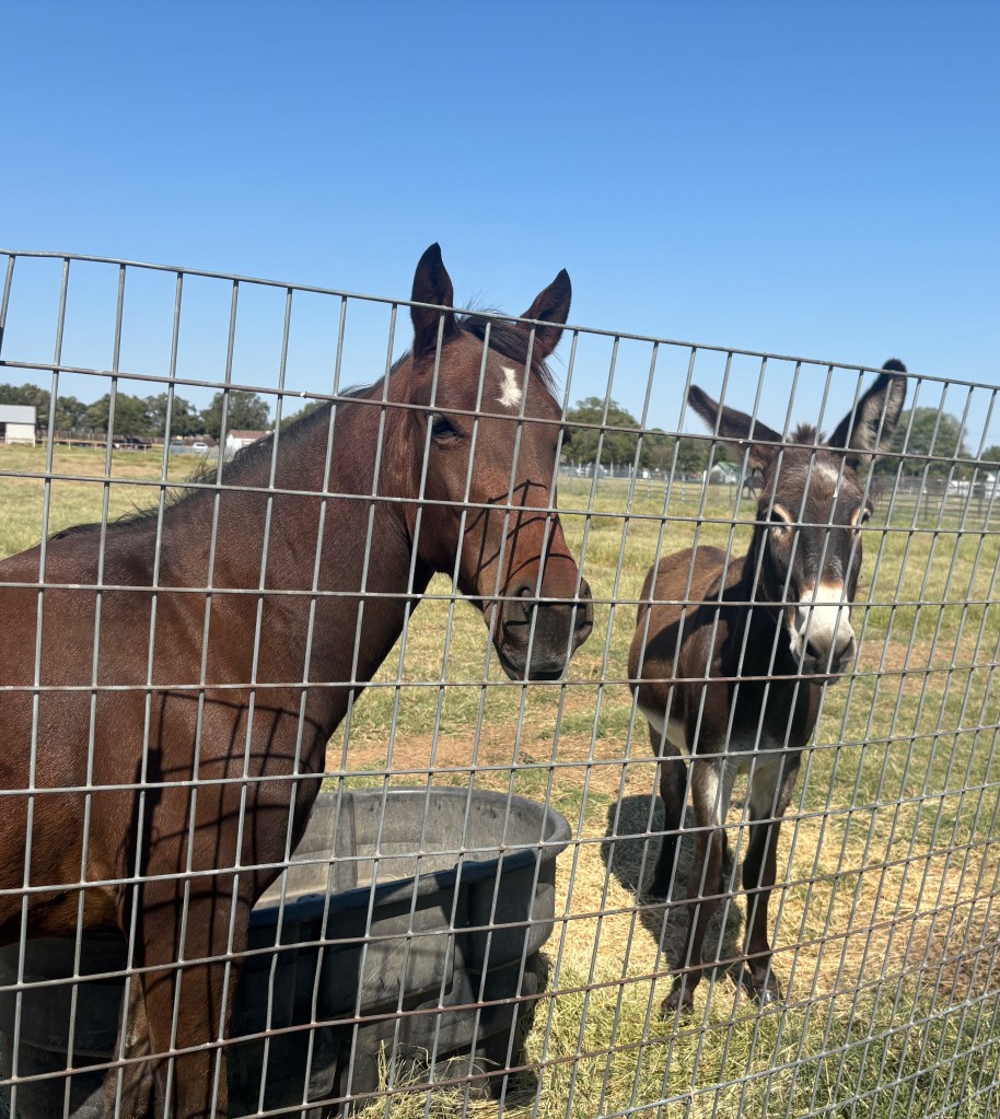
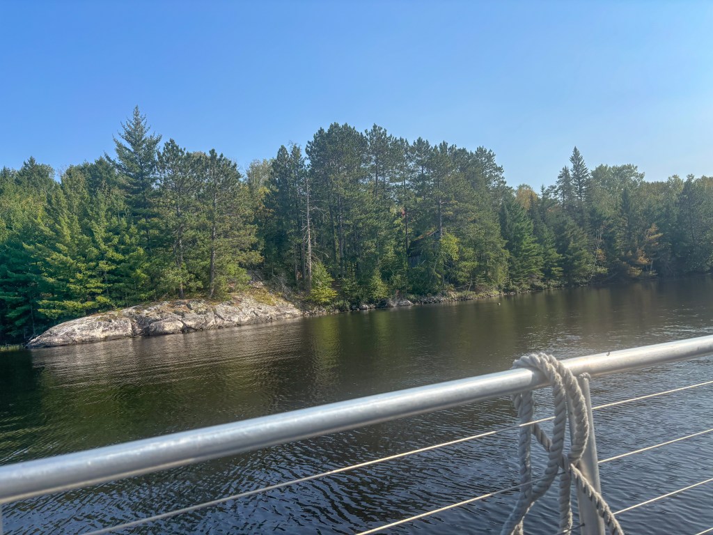
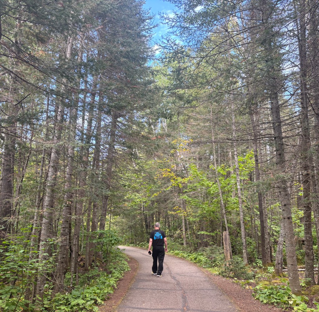
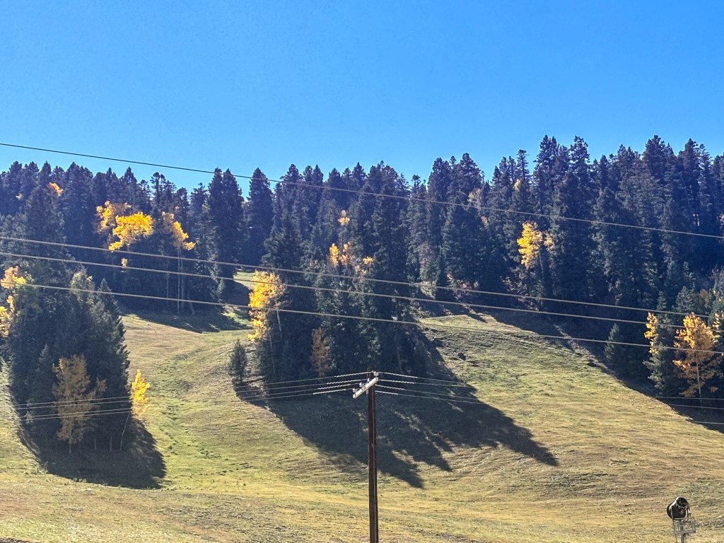
The drive from Carlsbad to White Sands National Park was far different than we expected. For many days (since leaving San Antonio) we drove through hundreds and hundreds of miles of flat, vast desert expanses across West Texas to Big Bend (elevation 1800’), continuing alongside the Guadalupe Mountains and up into southeastern New Mexico to Carlsbad (3295’) and beyond. We continued through these arid desert landscapes until about 50 miles before we got to White Sands. And suddenly we found ourselves driving up, up, up a very long, mostly divided highway, passing lots of green pastures (plus horses and cattle for the first time in days), more and more trees and eventually dense evergreen forests (for the first time since Arkansas), providing a backdrop for the stunning golden aspen. At the summit we discovered a very classy Ski Cloudcroft—New Mexico’s smallest and southernmost ski area at 8400’! What a glorious surprise!

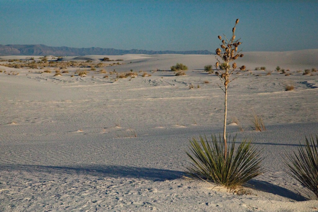
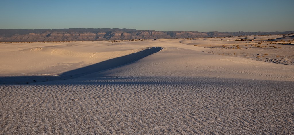
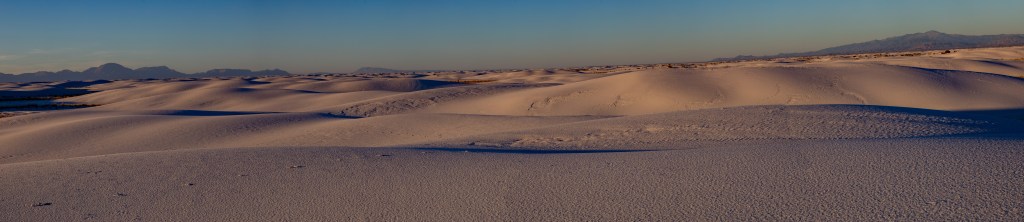
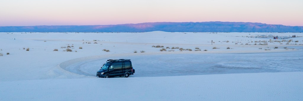
When we descended, we were treated to the vastness of the New Mexican plains and our first peek at White Sands (above right). With the little we’ve seen so far on this trip, we’re beginning to see why New Mexico is called “The Land of Enchantment.” And once again, we found a welcoming KOA Campground in nearby Alamogordo (where most businesses are) to spend 2 nights. Photographer Gary got very excited when he discovered there were so many photo possibilities at White Sands National Park at sunset, so we took off fairly soon the same day to see what we could find—about a 30-minute drive. We were surprised at how wet the sand was (and how hard it is to climb, since it’s very loose). We also discovered that White Sands is the largest gypsum dune field in the world, shelters over 800 species of animals and is described as one of the world’s great natural wonders. It was especially fun to watch some families sledding down the dunes (we passed on this) and also to photograph our very long shadows (love those long, skinny legs!). Here are some of the photos we took:


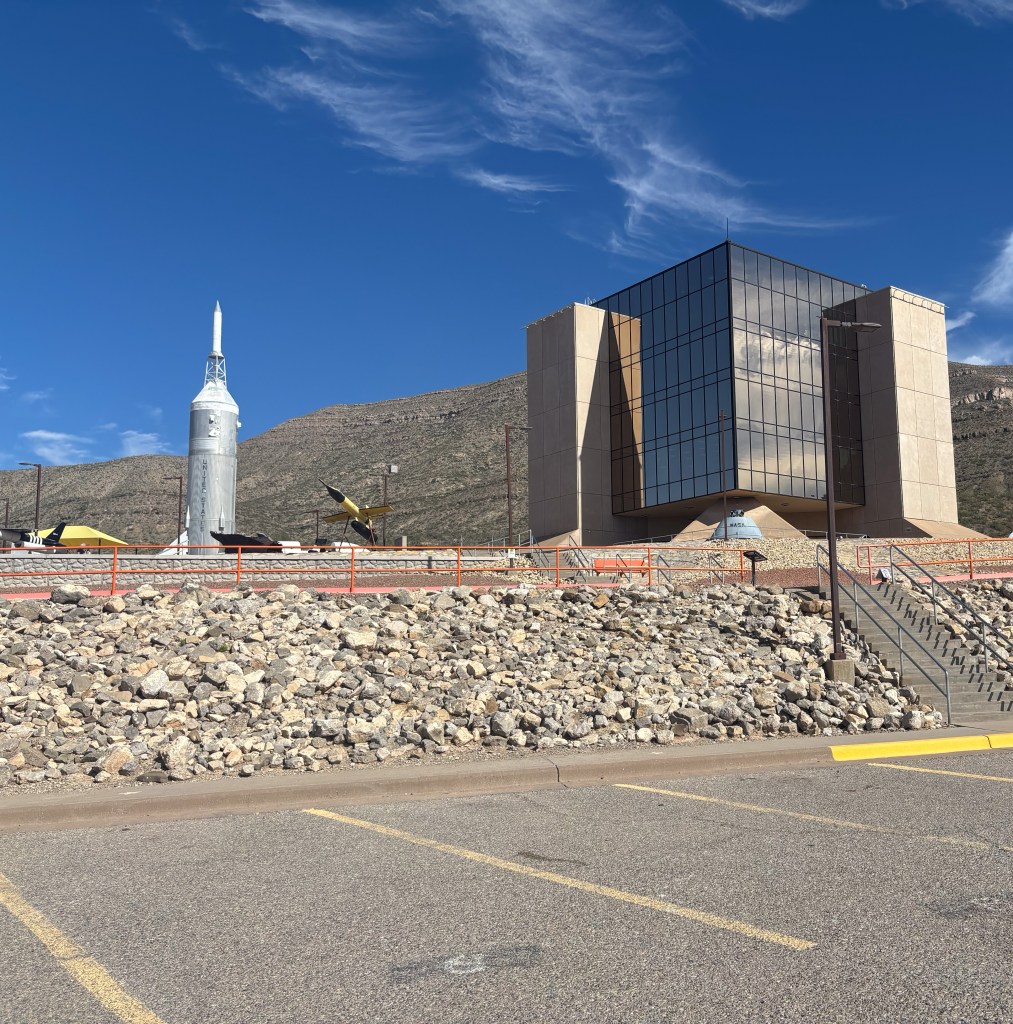
We didn’t realize (or had forgotten) how many scientific and military activities have happened and are happening around Alamogordo. Holloman Air Force Base (established in 1942) is home to the world’s longest (almost 10 miles) and fastest (almost 10,000’ per second or Mach 9)) test track. It also plays a key role in training F-16 and Reaper (drone) pilots from the U.S., U.K. and many other allied countries (including Ukraine). Nearby White Sands Missile Range (one of the key locations for the highly secret Manhattan Project—led by J. Robert Oppenheimer –and where the first atomic bomb was tested in 1945) covers 2.2 million acres in this area of Southern New Mexico and has evolved into the U.S. Army’s largest military testing area and firing range. In addition, we discovered and visited the modern New Mexico Museum of Space History (below) with amazing photos, films and exhibits that bring the story of man’s race to the stars alive, from the earliest pursuits… remember the space chimps HAM & Enos?!? This whole area is considered the birthplace of space exploration and we really enjoyed learning more about it. It was also fun to be entertained at the campground that night by a group of retired Air Force men who enjoy singing, telling stories and playing their guitars. Great fun!


This whole area has a much different vibe than places like Santa Fe and Taos (which we also love), and spending a little time in this part of New Mexico has been a fascinating and delightful experience.

(Footnote: Little did I know that when setting an intention last January to spend more time being “creative,” I could produce such creative spacing in our last blog! I think we’ve finally solved that glitch too, but it does give me an opportunity to practice “Oh-Well-ness”…as in, oh well!)

VAN – CHAPTER VI – TEXAS

October 21, 2024 from Carlsbad, NM
The drive from Hot Springs, Arkansas to Arlington, Texas was the first of several challenging days of driving in Texas, with way too much traffic. Even though there were several big electronics signs saying, “THE EYES OF TEXAS ARE UPON YOU/DRIVE FRIENDLY,” almost everywhere we went there were lots of construction zones, lane diversions and cement k-rails, together with speeding trucks and some of the craziest drivers we’ve ever experienced anywhere. For all the safe and decent drivers (the majority), there were dozens and dozens who had to go faster than everyone else and chose to weave across from the left lane to the right and back to the left at very high speeds. Others chose to dart across several lanes of traffic to rush to their freeway exit. It was very scary at times, especially when they whipped around the right lane behind us or cut across in front of us. Not fun! We are very grateful we’ve both had a lot of experience driving on urban freeways (mostly in the Los Angeles and San Francisco areas), and we continued to trade driving every 1-1.5 hour shifts, but every drive took much longer than expected and at the end of each day we were both pretty wiped out.

The very good news is that, each stop we made midst these not-so-fun drives, brought us a great deal of pleasure and enjoyment.

Our first Texas stop was in Arlington (a suburb of Fort Worth, southwest of Dallas) where we spent the night with a good friend and organizing colleague whom I’d known since the early 1990’s in Marin County, CA (where I lived for almost 20 years). We had a delightful dinner at a fabulous steak house and a delicious homemade breakfast with her while we caught up with each other since she moved to Arlington (for her mother’s last years) in 2016. Before we left, we drove to the Humane Society of North Texas’ Equine & Livestock Ranch (about 40 minutes south in Joshua, TX) where she works as a volunteer. I loved hearing the stories of each horse and donkey that was there—some surrendered because the owner couldn’t provide care any longer, some abused or in poor shape for other reasons—and the care and training they provide so that as many as possible can and will be adopted. Everyone there is passionate about their work and it was a joy to get a grand tour of this special place and also meet the two “ambassadors” who will not be adopted—the first horse they cared for (below left) and an amazing “Mammoth Donkey” who is one of the few who chose not to come to the fence to greet us and be petted as we visited each pasture. It was really fun!


Our next stop was another KOA campground north of Austin where we stayed for 2 nights. On Saturday, October 12, we joined younger daughter Laurie (who flew in from Connecticut for the weekend), her oldest son Ty, his very sweet girlfriend Kaylie and a dear family friend “Uncle Al” (who all live north of Austin) at Outback Steakhouse. We were there to celebrate Ty for two reasons: (1) He’d just passed his check-ride for his Commercial Pilot’s License 3 days before (aiming to eventually be a commercial airline pilot—he’s been in flight school nearby for 2 years), and (2) he was turning 21 the next day, October 13!! Of course we had to share a “bloomin’ onion” (and even with 6 of us, we couldn’t finish it). Each of us had a great dinner and shared some decadent desserts. We had such a good time and it was so fun to be part of this celebration!

As part of this milestone birthday, Laurie (who rarely drinks) was determined to “do a shot” with her awesome son. They both wanted to make it a 3-generation ritual so I hesitantly agreed to join in. (I don’t drink much either and had never done a shot!) The shot glasses were huge (3x the usual size) so we actually did two swallows instead of just one, with Laurie and I pouring some out before the second round. Gary took photos and a video of this whole escapade and we’re still giggling about it!

The next day everyone else continued with more celebrations while Gary and I finally solved our computer and blog-posting glitches and then rested up for a very fun evening. Older daughter Carolyn had told us the one thing we “had to do” in Austin was “see the bats!” When the Texas Department of Transportation remodeled the Congress Avenue Bridge downtown (in the 1980’s), the newly installed heat expansion joints left deep, narrow crevices between the beams that turned out to be the perfect bat habitat. The crevices protect the bats from predators and provide female bats with an incubator-like setting to raise their young. From early spring until mid-fall, over 1.5 million Mexican free-tailed bats emerge from the bridge at sunset to feed. Each bat is said to consume 1000 insects per hour, which helps mitigate the city’s bug problem and saves huge amounts of money and damage from pesticides. At any rate, many people view the bats from atop and along the side of the Congress Avenue Bridge, but Gary and I decided to take a Capitol Cruises boat tour hoping to get the best possible view—and we did! After a leisurely hour cruising “Lady Bird Lake” and hearing about the Austin waterfront, we (and many other boats and kayakers) were positioned perfectly, with the sunset beyond, to witness this amazing spectacle.

Red spotlights helped us see the first “scouts” come out. We were told that some of the bats had already left to winter in Mexico, so we weren’t sure if we’d see many…and pretty soon bats were coming out of every crevasse in the bridge. Even the cruise guides were surprised at the show for this late in the season. It was VERY exciting!!! We took several videos to capture it all (for our future enjoyment and yours!). Here’s the best one (click on the image below):


The next day, before leaving for San Antonio, we played tourist a bit in downtown Austin, driving through the campus of The University of Texas (home of the Texas Longhorns, where even the street signs are burnt orange), seeing the State Capitol Building (with construction all around, so hard to photograph) and spending some time in the Bullock Texas State History Museum “to see what makes Texas Texas,” from its earliest roots, through the Mexican Revolution, cattle and oil industries to present. It’s a beautiful museum, with fascinating exhibits and we enjoyed lunch there as well. We really liked Austin!

The final (we hope) chapter of our nightmare Texas freeway driving consumed us for the next 4 hours (usually less than a 2-hour drive) as we made our way from Austin to San Antonio through multiple construction zones, traffic delays and (sadly) more crazy zigzag drivers. We were exceedingly happy to finally land at our Hilton Garden Inn Hotel for 3 nights, less than 2 blocks away from the San Antonio River’s famous River Walk. We didn’t even go out of the hotel the first 24 hours….we just needed to de-stress and rest, so that’s what we did. Whoosh! We discovered the fabulous Landry’s Seafood Restaurant a short walk away and ate there twice. They had the best lobster bisque Gary’s ever eaten and the best alfredo and vegetable pasta I’ve ever had. They also served a remarkable caramel apple bourbon cake. We enjoyed all of this (and more) overlooking the beautiful River Walk.


Having revived considerably, we played tourist most of the next day, taking the 1.5 hour City Trolley tour mid-day to get a sense of the whole city and some of its history. Frankly, it was a bit disappointing because they route had a lot of construction on it and took us through several places that seemed pretty run down. However, we DID see the Alamo (symbol of Texas independence) and enjoyed some of the beautiful buildings both old and new throughout the downtown area, as well as some pretty parks. After some more rest and another yummy dinner, we walked a ways on the winding River Walk as the sun was going down and chose to take a 1-hour guided boat tour. It was a delightful way to experience the entire River Walk at night, with all its nightlife and music. What we liked best of all (other than simply being on the water) was the creative and colorful lighting of the buildings and many of the trees along the way (mostly bald cypress, cottonwoods and sycamores, some of the bald cypress being more than 200 years old). It was so beautiful! What a great way to remember San Antonio as we headed west the next day for Del Rio (where my #2 nephew Bruce was born) and our last stop in Texas, Big Bend National Park, right on the Texas/Mexican border.

We are so glad we chose to travel to Big Bend, which gets its name from the great U-turn the Rio Grande River makes here through southwest Texas, defining the park boundary for 118 miles and the 1200 miles between the United States and Mexico. It’s in a remote part of southwestern Texas and gets about 350,000 visitors a year (about the same as the Grand Canyon gets in a month—4,733,705 visitors in 2023).

The Park is known for its spectacular scenery and its superb walking, hiking, river running, stargazing and birding—over 450 bird species have been seen here with the largest migration occurring in the spring. What impressed us the most was the astonishing variety of rock formations, buttes, spires, striations and colors where vast desert lands (Chihuahuan Desert), mountains (as high as 7,820) and the river (Rio Grande) converge in one place. Because the desert was once an inland sea, fossils abound (from the smallest microbes to dinosaur bones) and the diversity of fauna and flora is fascinating—all amazingly adapting to what appears to be a very barren and harsh environment but is teeming with life despite its average 5-7” of rain each year. There are over 1300 species of plants, including 58 varieties of cactus. We were especially intrigued with the abundance of prickly pear and the yucca-like “sotol” with its tall spikes (below, part of the lily family, we discovered)…early inhabitants roasted its heart for food and used its leaf fibers for rope and sandals.

The only wildlife we saw were roadrunners (which I was hoping to see) and lots and lots of butterflies—some quite large. There are also Mexican black bears (at the higher elevations like the Chisos Mountains—the only mountain range that is completely within a National Park) and javelinas (that “look like a pig and smell like a skunk”), but we didn’t see either of these.

The first day we had a wonderful dinner at the Chisos Mountains Lodge, highly recommended by several travelers and the Panther Junction Visitor Center. The drive up and back was beautiful as we began to sense our touring the next day was going to be quite wonderful. Some of the odd and jagged ridgelines reminded us of those we saw on the Isle of Skye in Scotland in 2023.


Our basic but clean campground was a few miles north of the Park in a small town called Study Butte and adjacent to Teralingua, known for its famous annual chili cook-off. There were several funky eateries and ghost town remnants scattered around, lending itself to a fun vibe. The best place to eat was next to the ghost town called La Posada Milagre, which the locals refer to as Poco Mas.

The next day we drove back to the Park and spent several hours on the beautiful Ross Maxwell Scenic Drive that ended at Santa Elena Canyon, where the Rio Grande has carved an 8 miles long canyon through layers of hard limestone. Rising in the 14,000’ peaks of Colorado, the Rio Grande flows 1885 miles to sea level at the Gulf of Mexico. It is the “life blood” of Big Bend and its surroundings. We only walked to the opening of the Canyon, but we were in awe of its 1500’ high cliffs!

All and all, visiting Big Bend National Park was a fabulous way to end our visit to Texas. The Park is “a land of strong beauty, often savage and always imposing,” where one can find solitude and have an “awe of majesty of this place unlike anywhere else.” Its vastness is remarkable and quite beautiful.


This blog was a bit longer than usual, so thanks for continuing to travel along with us…I guess “big” Texas deserves a “big” blog!  🙂

VAN – CHAPTER V – IOWA, MISSOURI & ARKANSAS

October 13, 2024 from Austin, TX

Driving from Minneapolis to Des Moines was a straight shot south through miles and miles of corn, soybean and hay fields. As we drove farther south, the terrain had a few rolling hills to vary the beauty, and the drive was relatively easy. We didn’t do any touring in Des Moines as we were eager to get to Kansas City, our campground and the Chiefs vs. Saints Monday Night Football Game. When we describe our campground as the “Stadium RV Park,” do you picture a lot of RV’s and campers parked by the stadium having their version of a tailgate party? Well, we did. Turns out the RV Park was over 3 miles away from the Stadium and probably the seediest one we’ve ever seen, with permanent, broken-down trailers (some held together with duct tape) and trash all around them. It was “lovely!” I won’t describe the men’s room (with no sink!) and am glad the code to the ladies room didn’t work—I don’t think I wanted to see it. The “office” was the white jail-like cube in the photo below left. Need I say more?

At any rate, the good news is that it only took about 20 minutes to get to the Stadium and maybe 30 minutes to get back afterwards. We won’t go into the frustrations that occurred trying to find parking because the van is 10.5′ high (which we finally did, in the oversized vehicle lot) or the 3 hours it took to get our tickets downloaded, but we finally got to the game a few minutes after it started and from then on it was lots and lots of fun. Arrowhead Stadium is absolutely beautiful and it was easy to see every play. We were sitting toward the top and that turned out to be much quieter than if we’d been seated lower (like at Michigan). We’d heard this was “the loudest crowd in the NFL,” and I’d even taken earplugs, but they weren’t needed. Whew! It was fun to see Travis Kelce (87) and Patrick Mahomes (15) in person and cheer on the Chiefs. We sat across from the premium boxes, couldn’t see inside, but we’re told that Taylor Swift was captured on camera by the TV crew. Once again, the people all around us couldn’t have been nicer and the Chiefs won! We had a really fun time and enjoyed the celebratory fireworks. Attendance was around 72,000.


We slept well and found a really good breakfast place nearby. That’s when we decided to “recalculate” and cancel the second night at our lovely RV Park. When we couldn’t find any kind of a bus tour of Kansas City (including its many fountains), Gary discovered that Unity Village and Unity World Headquarters were only 20 miles away. We know several people who have enjoyed ceremonies, conferences and workshops there and were thrilled to immerse ourselves in 1200 acres of serenity, with beautiful Mediterranean-style buildings, extensive lawns, a beautiful rose garden, the “largest fountain display in the Kansas City metro area,” and an amazing 90’ diameter labyrinth! We also discovered there is a hotel on site with a wonderful cafe and bookstore, so that’s where we stayed that second night. The wondrous energy and beauty was quite different from our Stadium RV Park and we enjoyed every minute we were there. We love the t-shirt Gary bought there. It says, “Heavily Meditated!” Mmmmm…very nourishing!


Our next stop was Joplin, MO (another easy, straight drive south on a less-travelled divided highway). It was a good half-way point between Kansas City and our next National Park, in Hot Springs, Arkansas. We stayed at a very rustic but quiet campground along a small creek that was very peaceful and pretty (below). We started listening to a biography of President Harry S Truman that we wished we’d started sooner (before we drove from KC to Joplin). The author, David McCullough, is the same man who wrote the biography of Theodore Roosevelt that we listened to before we got to North Dakota. We really like the details he provides that give the reader special insights into how each subject’s character and career develops. In the case of Truman, we not only became more aware of how his leadership skills developed (as a well-liked and admired commander of a battalion of fellow Missourians he led to victory in WWI and as a civic leader), but also learned much more about how the Civil War affected this state, the ups and downs of Truman’s life and the role his whole family played in settling this frontier. Had we given it more thought sooner, we probably would have spent more time in Truman country.


From Joplin, we took a bit of a jog to the southeast, to visit Hot Springs National Park in Arkansas, about 50 miles southwest of Little Rock. I don’t think either of us had been to Arkansas before, so now we can both say that we have been in all 50 states!!! The driving continued to be fairly easy, although it was quite hilly and winding the last 50 miles, through the dense forests of the Ouachita Mountains to another KOA campground (we’ve enjoyed several this trip and really like them). The next morning we had breakfast near the Visitor Center and only after our visit there did we wish we’d done some advance research and spent more than a morning here. It turns out that people have been coming to these Hot Springs for centuries. Hot Springs became quite popular when promises of improved health drew Civil War veterans and others with disabling conditions to crowded camps near the open springs, seeking to ease their pain in the thermal waters. By the 1900’s, Hot Springs was among the most visited health and wellness resorts in the United States. It became the 18th National Park in 1921. Its ornate and historic row of bathhouses are quite fascinating, some of them still in use, and the town itself is a fun experience.


On the Central Coast of California (where we live), we don’t hear much about hot springs in the course of our daily lives, but after experiencing them in Iceland last spring and visiting these thermal waters in Arkansas, maybe we’ll seek out some others in our future travels to relax a bit and enhance our well-being. 

We started to include our time in Texas in this blog, but realized that there is way more to share during our time there, so this posting is a short one! On to Texas we go!

VAN – CHAPTER IV – MICHIGAN, WISCONSIN, MINNESOTA (Part II)

[Headnote (vs. footnote): We are home now and think we’ve finally solved the very frustrating computer glitches–mostly about transferring photos. Bless Gary for his persistence! There are still some spacing issues, but we’re doing the best we can. Thank you once again for your patience.
We had some amazing experiences during the rest of our trip and look forward to sharing them with you over the next week or so.]

October 6, 2024 from Kansas City, Kansas
We spent 2 nights in Ann Arbor and then we started the second half of our Van
Adventure by heading south and west to the only National Park in Indiana called
Indiana Dunes. That was the hardest drive so far—on Interstate 94, the main
route between Detroit and Chicago, where there were lots of trucks, many miles
of construction (and my favorite cement k-rails…not!) and the last 60 miles in pouring rain.
The drive took over 5 hours instead of the expected 3, so we were
very pleased to stay in a lovely forested campground in the nearby State Park
where we could finally relax and enjoy the much-needed serenity.
We’re glad there was a good introductory film at the Visitor’s Center because
most of the features in Indiana Dune National Park are accessible only by hiking
and we hadn’t allowed time for that. We did enjoy some of its beaches (15 mile
shoreline along the south end of Lake Michigan, with 2 giant steel mills in the
middle!) and were a bit in awe of its diversity—sand dunes, forests, swamplands,
prairies and beaches, with hundreds of species of birds, plants and butterflies.
AND, it’s the first time we’ve ever seen a sign for Turtle Crossing! We also drove
to the southern edge of the Park that borders GARY, Indiana, so we could of
course take a photo of Gary.


We then headed up the eastern shore of Lake Michigan, stopping at two of our
favorite marinas where we had stayed on our America’s Great Loop
adventure—Manistee and Leland. The marinas were both pretty much deserted (below),
in contrast to the mid-summer chaos of tourists and of Loopers preparing for the
journey through Chicago and down the rivers to the Gulf of Mexico, etc., but it
was very fun to revisit these places and eat at some of our favorite cafes. It was
also a good reminder that traveling by boat along the shoreline is a very different
experience from driving town to town. On the water, you have no idea what
lies inland, and it was a joy to drive through so many forests and fields and see
all the fruit stands selling blueberries, pumpkins, peaches and apples among the
orchards. It was all quite beautiful and so were the many inland lakes that we
passed along the way—some of them surprisingly large. We also saw a bit of fall
coloring midst the amazing variety of trees. All the roads were good and there
wasn’t much traffic as we made our way to Charlevoix (another favorite marina
stop near the top of Michigan), where we took the ferry over to visit with another
favorite Looper couple on Beaver Island in the northeast corner of Lake
Michigan.


Beaver Island is a haven unto itself and we love BEING here with such special
people. We visited 2 years ago after we finished our Loop and our friends now
live here year-round—right on beautiful Lake Geneserath, surrounded by forest
lands (above right). We got to go on a 2-hour pontoon boat cruise around this lake one
evening with some neighbors, and we loved seeing the beavers, loons (below left) and
another beautiful sunset. The next day Gary helped mill a cedar log, turning it
into a beautiful 5” square beam! It was so nice to chill for four nights in a row in such
a nourishing environment, with delicious food and good conversations.
It was all very good for the soul!


After Beaver Island, we had the privilege of taking an historic steam-powered car
ferry, the SS Badger, (that used to ferry railroad cars) from Ludington, MI across Lake Michigan to Manitowoc, Wisconsin. This is the first time we’ve taken a ferry where the crew loaded and unloaded our vehicle–below right). The 5-hour crossing (60 miles) across the middle of the Lake was very relaxing (we DO love being on the water!), and then we spent a delightful 3 nights with another of our favorite Loop couples. They are both extraordinary artists and it was fun to see their
work spaces and enjoy their welcoming home with a wondrous view of Lake Michigan, just a few blocks from the Manitowoc Marina where we had docked on the Loop. They took us to Hennings Cheese Factory “out in the country” where we sampled and bought several yummy cheeses. We also stopped at an awesome restaurant on the way back where we had the best fried cheese curds ever (below). At dusk we went to a pond near the zoo where there were over 100 sand hill cranes
enjoying the waters and each other. This was our first experience hearing the sounds of the cranes, which we videoed for our and your enjoyment (click last photo below). We had such a good time with such a wonderful, fun couple.

We then drove across the state of Wisconsin to a campground near the border of
Minnesota called Willow Lake State Park. We passed through many forests and
thousands of acres of green grasses and cornfields plus dozens of dairies, very
pleased it was a divided highway the whole way—an easy drive. We were able to
check in early at a hotel near the U. of Minnesota football stadium where we
attended the USC v. Minnesota game Saturday night. The day before I spent a
wonderful afternoon with a NAPO colleague and good friend I’ve known since
1996 who lives in nearby Plymouth. On Sunday, before heading to Des Moines,
we had a delightful brunch with the widow of a dear Colorado College classmate
of mine near her home in Edina. It’s nice to stay in touch with good friends!

The University of Minnesota’s Huntington Bank Stadium is half the size of
Michigan’s, seating 50,805 and sometimes called “The Bank.” We’re very glad
we attended the Michigan game in The Big House (probably a once in a lifetime
experience for us), but the Minnesota game was frankly much more enjoyable.
It felt more like a real college football game with a stadium that felt more
intimate…where it was easy to see what was going on…where the fans were just
as friendly but not nearly as loud (no screeeeeaming!!!)…and the only time we
looked at the Jumbotron in the end zone was for a replay. We also had four very
fun “grandsons” behind us (students at St. Thomas College, below) who adopted
us as their “Me-Maw and Pe-Paw” and bantered with us all night…lots of laughs! The whole
experience was very fun and a nice way to end our time in Michigan, Wisconsin
and Minnesota. We were disappointed that USC lost both games we attended,
but we certainly created lots of wonderful memories with lots of special people.


Next we make our way to Texas, driving almost directly south through Des Moines, Iowa, plus Kansas City & Joplin, Missouri. We’ll stop in Arkansas at Hot Springs National Park and then we have some fun times planned in Texas. We haven’t seen a lot of these places before, so it will be fun to have you with us as we drive along! (Hmmm….I do use the word “fun” a lot! Why not?!?) Cheers!

VAN CHAPTER III – MINNESOTA-WISCONSIN-MICHIGAN (Part I)

September 28, 2024 from Beaver Island, MI
Our first stop in Minnesota was just east of Fargo, SD at the Buffalo River State Park Campground. For the first time, we were on Central Time (starting half way across South Dakota—one of 11 states whose time zones are split…very weird, but pretty easy to adapt to). We were more tired than expected after a long drive (including the Enchanted Highway detour)…and realized that the constant heat and perhaps the half-day of smoky skies were taking their toll. We did find a fun and fairly typical Saloon along the way (note our van parked just outside), with a sign that made us chuckle:


We slept well (as we usually do), and the next day we drove across the northeastern part of Minnesota, with endless acres of grasses and grains (above right), excited to see Voyageurs National Park just east of International Falls, along the Canadian border. All the campgrounds were “first come/first-served” and a lot of them were surprisingly full, but we found the perfect spot and got another good night’s rest, very ready for a boat tour to Kettle Falls and back the next day.

Named for the 18th Century trappers who blazed the watery trails through this region, Voyageurs National Park spans nearly 350 square miles and little of it is accessible by car. That’s why we signed up for a 5-hour boat tour, which was the perfect way to see and learn more about this remote and beautiful water wilderness area. 40% of the Park is water—80,000 acres—and it is on the edge of the Canadian Shield, with its exposed granite (2.7 billion years old!) and tree-lined shores—mostly white pine, spruce and ash, in the heart of Minnesota’s North Woods and also on the southern edge of the Borreal Forest. It reminded us of Georgian Bay, where we cruised across the top of Lake Huron in 2022. There are over 500 islands (mostly uninhabited) and it was quite beautiful, very relaxing and peaceful. Gary really took it in, declaring, “Nothing like being on the water!” Ahhhh, yes indeed!

Learning about the French trappers (“voyageurs”) was really fascinating—men of legendary strength and endurance who paddled birch-bark canoes laden with goods between northwestern Canada through these waters (as well as the adjacent Boundary Waters Canoe Area Wilderness (BWCAW)—over 1 million acres) all the way to Grand Portage (our next stop) on the shores of Lake Superior (and sometimes on to Montreal). In fact, per the Treaty of 1842 between the U.S. and Great Britain, the international border in Minnesota, Wisconsin & Michigan follows the customary trade route of the voyageurs! We’re glad we were able to tour Voyageurs before our next stop on the shores of Lake Superior.
We had hoped to see a bull moose at Voyageurs—they are sometimes seen swimming between islands—but we did not, so our legendary “moose chase” continues! We did see several stunning bald eagles and their nests and that was very fun. (There are more than 50 pairs in the Park right now.) There are also many wolves on the islands, but we didn’t see any of them either, so we stopped by the International Wolf Center in Ely, MN on our way to Lake Superior, hoping to see some there, only to learn they are “crepuscular” animals (as are moose and many other species) who are most active at dawn and dusk, so all 4 “Ambassador Wolves” were not visible in their 1.5 acre compound (below) while we were there. We did learn a lot about their habits and howls and their relationship to the wildlands, so that was good.


We spent 2 nights at Grand Marais on Lake Superior’s North Shore and took the North Shore Scenic Drive all the way up to the Canadian border and Grand Portage State Park where we walked through the forest to High Falls (120’—highest in Minnesota). We could hear the roar of the falls way before we got there! What a beautiful way to spend a morning!

It was at Grand Portage (meaning “The Great Carrying Place”) that goods and canoes had to be carried over land to avoid waterfalls and rapids too dangerous to navigate. We’re very glad we stopped at The Grand Portage National Monument and Heritage Center where we learned how important Native Americans were to the explorers and traders. They furnished sought-after pelts, equipment and knowledge essential to the voyageurs, taught them how to build canoes and guided them along the water routes into the wilderness.

Three things we’ve noticed in our travels through Minnesota and beyond that we’ve not seen elsewhere: lots and lots of cars, jeeps and campers carrying canoes and a huge number of yellow snowmobile and cross-country skier road signs. Minnesota, Wisconsin and Michigan are known for both summer and winter sports. In fact, friends from the Loop who live in Cable, Wisconsin are very avid cross-country skiers and have helped for years with Cable’s annual American Birkebeiner, North America’s largest cross-country ski race. They met us for lunch in Bayfield, Wisconsin overlooking Lake Superior’s Apostle Islands National Seashore (where they used to keep their boat). What fun it was to visit with them!


From the Apostle Islands, we made our way into Michigan (and Eastern Time) through the town of Houghton to the very remote Sunset Bay RV Park and Campground, once again on the shore of Lake Superior. By the way, Lake Superior is the largest fresh water lake in the world by surface area—31,700 square miles—350 miles long and 160 miles wide. It borders 3 states (Minnesota, Wisconsin & Michigan) and 2 countries. By volume, Lake Superior contains 10% of the world’s fresh water by holding 440 trillion cubic feet, second only to Russia’s Lake Baikal. We felt very blessed to stay on her shores in 3 different campgrounds, in 3 different states. We especially enjoyed stopping at Split Rock Lighthouse and seeing the sunset (and storm front) at aptly-named Sunset Bay RV Park.


Driving across the Upper Peninsula (U.P. to locals, who also call themselves “Yoopers”) was a treat as we continued on mostly 2-lane “roads less traveled,” through lots of small, very rural towns, including Manistique, where we stayed on the north shore of Lake Michigan and enjoyed a walk on its sandy beach overlooking its lighthouse. (The beaches we saw on Lake Superior were mostly pebbled.) We visited the fascinating old Seul Choix lighthouse nearby (center) built in 1895 and pronounced “Sis Shwah,” meaning “only choice,”) where boaters sought refuge from a giant storm on the Lake. We also began to see wild turkeys and more monarch butterflies that migrate here each summer. It was very fun to drive OVER the Mackinac Bridge (that we had boated UNDER 3 times) that connects the Upper Peninsula to the main part of Michigan (aka “The Mitten”) as we made our way to the western shore of Lake Huron. We spent a night there before arriving in Ann Arbor. (We do like camping on lakes!)


On September 20, after driving a total of 4900 miles (!), we finally arrived at our most-eastern destination on this Van Adventure and settled into a Red Roof Inn not too far from the huge (25 square mile) University of Michigan campus and some beautiful old neighborhoods. We knew parking for the USC v. Michigan game would be a problem, so we were thrilled when we found out there was a driver nearby who could shuttle us to and from the game the next day. He picked us up at the hotel, dropped us off at the stadium, picked us up afterwards (a bit of a walk) and drove us back to the hotel. Attending this game in “The Big House” was quite the experience!!! We got there early and were a bit overwhelmed by the acres of tailgate parties going on everywhere we looked—90% Michigan. It was a joy when we’d see another USC Trojan fan, always exchanging “Fight On!” chants as we passed. And once in the stadium we did our best to hydrate and stay cool in a very hot sun (92 degrees) as both teams warmed up and more and more people arrived. (Did you know that the officials do warm-ups too?!? We watched one go through all his hand signals!)

The game itself was quite a trip! We had great seats (10th row, on the goal line), and we knew Michigan fans love their football, but we were not prepared for everyone standing most of the game and screaming (yes, not just yelling but screeeeaming) every time USC had the football. It took some getting used to, but frankly I saw most of the game on the huge Jumbotron screen above the end zone. USC didn’t play that well in the first half, but we both perked up quite a bit (after a fun halftime performance by the huge UofM band) when they started scoring in the second half and we exchanged high-5’s with the few USC fans around us as we finally went ahead. The game got very exciting and came right down to the wire, with Michigan winning in the last 35 seconds. AND, what we liked best was that the Michigan fans all around us couldn’t have been nicer! There were several couples and several families nearby, and we all congratulated each other on a great game. Even on the way out, Michigan fans were gracious and some went out of their way to make sure we had a good experience. That felt really good! Toward the end, they announced the attendance: 110,702!!

I don’t think we’d ever do this again, but it was very fun to experience USC’s first football game as part of the Big Ten. Fight on!

VAN CHAPTER II – WYOMING, SOUTH DAKOTA & NORTH DAKOTA

September 13, 2024 from Grand Morais, MN

Feeling very uplifted after our visit to Mile Hi Church, we ended up driving all the way from Lakewood, CO through Cheyenne & Fort Laramie, WY (where we had planned to stay the night) to Wind Canyon National Park in South Dakota! We arrived after dark (a new experience), but that made it easier to rearrange the next few days so that Gary could go to a Celebration of Life for his favorite cousin in West Los Angeles on September 4. Fortunately, Rapid City, SD is central to all 4 places we planned to visit in this area and had convenient flights via Denver to LAX and back, so we were able to see everything we’d originally planned AND Gary got to be with lots of family members for the service at UCLA.

We had never heard of Wind Canyon National Park before we started planning this adventure. It is in the southwestern corner of South Dakota and was discovered in the 1880’s when 2 brothers heard a loud whistling noise and traced it to the cave’s only natural opening, where the wind from the cave blew the hat off one of the brothers. This strong wind (which gave the cave its name) results from the difference in atmospheric pressure between the vast cave and the surface. It is home to one of the longest and most complex cave systems in the world, rich in honey-comb-shaped calcite formations known as “boxwork” (right, below). We enjoyed looking at the photos at the Visitors’ Center, and frankly, neither of us was disappointed when we were told the elevator (going 238’ deep into the cave!) was out of order. We both are a bit claustrophobic and we were happy to enjoy the photos and the extensive grasslands and ponderosa pines on top of the cave! As we proceeded to the nearby 18-mile Wildlife Loop, we saw our first bison on this trip, together with white donkeys and several large prairie dog towns.


We then drove to Badlands National Park (88 miles southeast of Rapid City), learning that it’s called “badlands” because the fur traders saw them as “bad lands to travel across,” with deep canyons, jagged buttes, pinnacles and spires (that were quite inSPIRE-ing!), juxtaposed against the extensive mixed-grass prairie—the largest in the country. It felt a bit eerie and otherworldly. It was also very hot (high 90’s) so we stayed in our air-conditioned van most of the time, stopping several times along the Badlands Loop State Scenic Byway to capture some of its rugged beauty. We were happy to find a nearby KOA campground—the only place with shade. Whew! In the evening we also enjoyed an Interpretive Ranger’s talk about the area and the night sky, and took in the cool breezes at the local amphitheater.  


We opted to stay at a Courtyard Marriott in Rapid City so I had a safe and comfortable place to stay for 3 nights and the airport was only 20 minutes away so Gary could go to LAX and back pretty easily. I enjoyed lots of “being” time and also watching some of the U.S. Open Tennis Tournament, as well as writing our first blog and reading up on some of the places we were going to go from there. (Gary usually figures out the stops and then I do most of the research to help us decide what to see and do.) After he got back, we took a full day to just “chill” together (hot weather, but nice air-conditioned room with a great restaurant). We then drove west to one of our favorite campgrounds so far, Timber Ridge, where we stayed 2 nights and toured Mt. Rushmore and the Crazy Horse Memorial, both in “The Black Hills” of South Dakota, named for the inky shade of their ponderosa pines and considered sacred by the Lakota Sioux for millennia. Because of the passions of a few artists creating these two memorials, the land has become hallowed in a different way

We had been told by several people that the Mount Rushmore National Memorial was “really small and disappointing,” but we were in awe of it and fascinated with the displays that showed how it was created. Conceived in 1924 by Danish-American sculptor Gutzon Borglum, the monument was to be a “Shrine of Democracy,” tracing the country’s history by way of its leaders, from its birth (Washington), through its early growth (Jefferson), preservation (Lincoln) and later development (Teddy Roosevelt)—“an impressive tribute to freedom and democracy in America.”  The faces are 60’ high (6 stories), carved into the naked granite and were completed in 1941 (when funding ran out before the upper torsos were completed). It was also fascinating to see a photograph of the rock formation before the work began (below left). We discovered that 90% of the “carving” was done with dynamite. Borglum and his son worked from a studio model that was 1/12th actual size, as they coordinated the efforts of local drillers, hard rock men and dozens more. I think the reason it looks “small” is because the viewing center is quite some distance from the monument, but the viewing entrance walkway included the flags of all 50 states and all U.S. territories, and for us it was quite beautiful and very inspiring.


The Crazy Horse Memorial was also fascinating and inspiring in an entirely different way. It was the vision and dream of Chief Henry Standing Bear and Boston sculptor Korczak Ziolkowski to create a tribute to the Native Americans and to showcase a great hero, the Oglala Lakota warrior Crazy Horse who defeated General Custer at the Battle of Little Bighorn in 1876. The dedication blast took place in 1948 and, since Korczak’s death in 1982, his children and grandchildren continue to oversee the blasting and sculpting crews year-round as they work to complete what will be the largest mountain carving in the world—563’ high and 641’ long, depicting Crazy Horse seated upon his spirited steed. The studio model being used is 1/34th actual size. Only the head (over 80′ tall) and part of an extended arm are finished. Below are images of how it looks now and what it will look like upon completion. It could take a very long to finish when you consider they’ve already been working on it for over 70 years!


The adjacent Indian Museum of North America was also very inspiring, with its extensive collection of art and artifacts (11,000!). We learned that Crazy Horse is “a mountain and so much more,” including an Indian University and other programs to preserve the culture and educate youth so they have a positive impact on the world. The tagline for Crazy Horse is FOLLOW YOUR DREAM. Before we left the Museum, we were invited to a talk and a healing “jingle dance” by a Lakota woman and her daughter, closing with a poignant Lakota teaching that we hope more and more people become aware of and believe:
MITAKUYE OWASIN (pronounced Me-da-ku-ye Oh-wa-say”) meaning
ALL LIVING THINGS ARE RELATED, CONNECTED AND ARE ONE

We were reminded that everyone has a light within them, some quite bright and some (who have been deeply hurt) quite dim. Those with brighter lights (who have overcome their hurts) are encouraged to shine their lights on everyone so we can all help make the world a better place. Amen!

Our next stop was 275 miles north at the Medora Campground in North Dakota to visit Theodore Roosevelt National Park. We’d been listening to a biography of Teddy since leaving Colorado and learned so much about him and his family before we got here. Teddy was fascinated with every kind of living thing from the smallest bug to the largest mammal and originally he had come to North Dakota to find a trophy bison bull. He was successful, but he found great peace and a “lonely freedom” in this wild country known as the badlands. This deepened his appreciation for the natural world and all its beauty and led him to become a true conservationist. As our 26th President, Roosevelt established the U.S. Forest Service and backed legislation to create wildlife refuges, national forests, national parks and national monuments, placing over 230,000 million acres under public protection so that these natural wonders could be preserved for many generations to come. Only part of the Scenic Rim Drive was open, but we certainly enjoyed the stark beauty of this strikingly shaped landscape among the trees and grasslands. We also loved seeing the “feral” horses who live here (not mustangs, but former ranch horses who refused to leave). There was a huge herd of them as we approached our campground and later we saw a group on the Rim Drive.


The next morning we awoke to very smoky skies (from fires in Wyoming to the west)) and we were very grateful the skies had been clear when we were driving the Scenic Rim Drive the day before and cleared soon after we turned east toward Fargo ND. We took a short but highly recommended detour called “The Enchanted Highway,” and came across seven huge metal sculptures over a 32-mile road, all created by a self-taught metal sculptor named Gary Greff (who happened to be in the gift shop at road’s end so we could sing his praises). Below are some of his sculptures, some taking over 6 years to complete. The last one (Geese in Flight) is over 100’ high and can be seen where the Enchanted Highway meets the main interstate. All of these sculptures were amazing—the largest scrap-metal sculptures in the world—and we’re very glad we chose to take this detour!

PHOTOS OF METAL SCULPTURES

We now go on to Minnesota, Wisconsin and Michigan, where we’re sure we’ll find more and more beauty. We also get to meet up with three or our favorite couples whom we met on our America’s Great Loop boating adventure 2021-22. More coming soon! It’s very fun to share some of our experiences and photographs with you!

OFF WE GO ON ANOTHER SPRINTER VAN ADVENTURE!

CHAPTER 1 – CALIFORNIA TO COLORADO
September 4, 2024 from Rapid City, SD

HEADNOTE (as opposed to a footnote): Due to crazy-hot weather, then sketchy internet and then various computer glitches, we’re very behind on our blog posts, but alas all systems are now go! Thanks for your patience!        

We’ve driven over 2300 miles already in our trusty Mercedes Sprinter Van—our first camping trip since 2020. We had less than 3 months to prepare for this one, but fortunately we kept good checklists from 3 earlier van trips so it was much easier to prepare. The van is in pretty good shape and we still have all the plastic containers we use to store everything we need—clothes, toiletries, camping & cooking gear, tools, electronics, photography equipment, art supplies plus assorted blankets, cushions, towels, LOTS of water and some snacks and other foods. There are storage boxes on the back for our cook stove, mini BBQ and cooking gear. (For safety, it is important for propane to not be inside the van.) Gary planned all of this very well when converting an 11-passenger van to a camper, complete with queen murphy bed (and a very comfy mattress), drop-down table & bench (that comes down from the bottom of the bed per photo below), chest of drawers (on left, from photo taken at head of bed), compost toilet and refrigerator. It’s quite the set-up! Here are some pictures that might help you picture how we are traveling.


We left our very cool (68 degrees) coastal town of Los Osos, California on Saturday, August 24. This trip was inspired because, now that USC is in the Big Ten conference (football), Gary wanted to watch USC play Michigan in “The Big House”—a 110,000-seat stadium at Ann Arbor. We’ll also go to USC vs. Minnesota 2 weeks later and added a Kansas City Chiefs vs. New Orleans Saints home game on October 7. On the way to and from, we also plan to visit another 14 National Parks (to add to the 31 we’ve already seen) and we’ll get to see my two oldest grandsons (in Austin, TX and Flagstaff, AZ). We are very excited and are already having a grand time. We sure live in a beautiful country!

The drive to Las Vegas via Barstow is usually a pretty boring drive, but knowing I was going to write some more blogs, I looked at it all with fresh eyes. The first day we went from the coast and coastal hills through the abundant vineyards of Paso Robles and the iconic golden hills scattered with oak trees, then many nut tree orchards. (FYI, California grows 80% of the world’s almonds, 75% of walnuts and 98% of the world’s pistachios!) The road then gets into a pretty barren stretch of desert plus a very ugly oil field with hundreds of bobbing oil pumps placed very close together—sadly, less than beautiful!


Before getting to the “high desert” of Mojave where Joshua trees abound (below, left) and mountains reappear, I had forgotten how many other things of note are located along this highway, including Edwards Air Force Base (where Chuck Yeagar became the first human to break the sound barrier in 1947 in his X-1 rocket plane). Naval Air Weapons Station China Lake is nearby (“the most important place you’ve probably never heard of”) where many large strategic nuclear weapons, rocketry and guidance systems were and are developed and tested. We also passed Jeff Bezos’ (Amazon chair) Blue Origin facility—aerospace manufacturer, launch service provider and space technology, as well as aeronautical engineer Burt Rutan’s headquarters where he designed & built SpaceShipOne, the first private spaceship to outer space (2004) and experimental airplanes called VeriEze & Long-EZ (John Denver was killed in one in 1997). We passed several wind turbine farms, and, as we got closer to Las Vegas, we discovered a fascinating new solar installation at the foot of the Clark Mountains. It’s called the Ivanpah Solar Power Facility where the sun heats up these large heliostat mirrors atop huge towers and special boilers then create steam power. It was quite a sight to see! (Gary actually provided most of the above information as we were driving along. I continue to be in awe of how much he knows about so many things…I call him “Walker-pedia!”)


At any rate, we woke up early the second day in Barstow and had planned to camp out in Las Vegas, but frankly, we no longer enjoy this haven of glitter and its showy 4.5 mile “Strip,” (although we’ve seen some great shows there over the years, including our favorite Cirque du Soleil’s “O” water show), so we decided to keep driving and went all the way to St. George, Utah—274 miles. (It really helps that we take turns driving—switching about every 1 to 1.5 hours, especially when we have a long drive. Most drives on this whole trip are 2-4 hours—and rarely a maximum of 6. This rhythm works well for us.)

It was in southwest Utah that the landscape became greener and the weather got much warmer (as expected), AND, the scenery got better and better too. I’ve always been fascinated with the rock formations—their varying colors and shapes—so it was very enjoyable to take in this enchanting beauty as we made our way to Lake Powell and Page, Arizona (part of the Glen Canyon National Recreation Area). This is where we spent several days during our first Van trip in 2018 to the Grand Canyon, the nearby amazing Antelope Slot Canyons and Utah’s southern National Parks (Arches, Canyonlands, Capital Reef, Bryce, Zion)—all such stunning wonders of nature! The only confusion was driving in and out of Pacific and Mountain time zones several times as we crossed from Nevada to Utah, then through the NW corner of AZ (no Daylight Savings there) and back into Utah and back into Page, AZ…all in a matter of 4 hours! I suppose people who live and commute in this area have figured it all out.


We stayed at the Antelope Point Marina for 2 nights. This is where we saw our first “wildlife!”…a grasshopper perched atop a tube of Eucalyptus Body Scrub left behind in the ladies’ room! 🙂 The highlight of this stay was a boat tour up Navajo Canyon—one of 93 canyons on Lake Powell. We learned a lot more about the Navajo culture and also about the geology. (Did you know that a mesa is always wider than it is tall and that a butte is just the opposite—taller than it is wide? Arizona and Utah have an abundance of both.) The weather was VERY HOT (high 90’s) most of the time, so it was nice to get out on the water and feel a bit of a breeze. Here are some photos from that 2-hour guided cruise…note the white high water marks on the Navajo sandstone:


Temperatures remained in the 90’s all the way to South Dakota, so we were very mindful of staying hydrated. Before we left, we splurged on two large, heavily insulated YETI mugs ($40 each, below left). They keep the water very cold for several days and even ice remains for 2 days or more. Pretty amazing and worth every penny! Knowing we would probably be in hot weather, Gary installed a portable air conditioning unit on top of the refrigerator to use when the car is parked. What a huge difference that has made! We also have small fans on either side of our bed and another at the foot, so we’ve managed to sleep pretty well. They run off a small Goal Zero inverter that sits atop our chest of drawers. The solar panels and extra car batteries Gary had installed have allowed us to have all the power we’ve needed. We even have little touch lights beside our bed for reading. What a clever and creative guy he is and I so appreciate all the ways he’s thought through the van conversion. There really is a place for everything and it’s a pretty fun way to travel. Speaking of heat, when we got back from lunch and the boat tour (gone about 4 hours), I picked up the large bottle of Airborne Gummies to take one (to enhance immune system), and the entire contents had MELTED into one big blob! Yikes and yuck!


We had a fun drive through familiar territory from Page to Monument Valley and Moab, Utah to Grand Junction, Colorado (the junction of the Colorado and Gunnison Rivers). We stopped for lunch at Zax, our favorite restaurant in Moab, where Gary bought a shirt he “had to have,” reminding him of a jeep road adventure he took in 2019 down into one of the canyons. (See photo above right!) Our campground sat on the banks of the Colorado River—the same river that fills Lake Powell and powers its way down the Grand Canyon. It was was very peaceful walking there.


We then visited Black Canyon of the Gunnison National Park and it was like nothing we’ve ever seen. (On our way there, we finally saw some “real” wildlife—a very healthy coyote ran across the road in front of us!) “Black” is very appropriate for this awesome gorge in western Colorado. The canyon is so deep and narrow that in places sunlight reaches the Gunnison River at the bottom only briefly, at midday. Its narrow walls stretch 2700’ high from the bottom toward the sky. We drove the 7-mile long South Rim of the Canyon and stopped at several view points, astounded at the sheer cliffs (where elite climbers dare to practice their sport!), carved by the rushing snow-melt waters of the Gunnison, appropriately referred to as a “liquid buzz saw!” Wow! I lived in Colorado for 7 years and never knew it was there!


On our way to Lakewood, a suburb of Denver, Colorado, we drove over Monarch Pass (11,312’) and the Continental Divide, where waters to the West flow toward the Pacific and to the East flow toward the Atlantic. Monarch Pass was a favorite ski area when I was at Colorado College in Colorado Springs… about 130 miles away. In the late 50’s, it wasn’t well known except to locals, so, with no lines, we would make dozens of runs in a day and have a glorious time!


Our last stop in Colorado was in Lakewood where we opted to stay in a hotel near the Mile Hi Church (part of the Centers for Spiritual Living that Gary and I have been affiliated with since the early 90’s). We totally enjoyed everything about the service, sat next to two practitioners who used to live in Santa Cruz and especially enjoyed one of our favorite songs, “LET THERE BE PEACE ON EARTH…AND LET IT BEGIN WITH ME!” Yes!!! There was a chant sung at the beginning of the service that really resonated with me, as I continue to practice, radiate and inspire peace, love, joy, order and harmony in the world: 

            I CANNOT DO ALL THE GOOD THAT THE WORLD NEEDS,
BUT THE WORLD NEEDS ALL THE GOOD THAT I CAN DO.

The next chapter in this Sprinter Van Adventure will cover our travels through Wyoming to South Dakota and North Dakota and several more National Parks. Bless John Muir, and Presidents Grant, Wilson and Theodore Roosevelt for founding these treasures of natural wonder, together with all those who work to maintain and preserve them for all of us to enjoy. They do good!

As always, thanks for traveling along with us! More blogs to come sooner than later!!! 🙂

ICELAND – PART IV – Reykjavic, Boston, Home & Summary

June 10, 2024
After spending a few hours at the Solvangur Icelandic Horse Center, we finally got back to Reykjavic and our favorite “home away from home,” The Holt Hotel–The Art Hotel.” If you ever journey to this part of the world, we highly recommend staying here—it’s small, convenient, their breakfasts are the best and their service impeccable. After we packed up all our cold weather clothes (which we shipped to them beforehand and they held until our arrival), they happily shipped that box back to our home. We also met the owner who is an absolute delight and was thrilled that we so appreciated her father’s extensive art collection.

It was also fun to look back on our two weeks in Iceland and appreciate how many different experiences and adventures we had. Reviewing all of our Iceland blog posts, there are only three things we can think of that didn’t fit into any of our narratives. First of all, we couldn’t believe the number of Teslas we saw all over Iceland—I guess it’s the perfect place for them, with the Icelandic energy-conscious way of life. Another thing we realized about Iceland is that there was far more exposed dirt than we expected, thinking most of Iceland was covered in ice! Not so! (Perfect example below, left.) We were also intrigued with the number of houses in several different towns that were constructed from corrugated metal, often painted in bright colors. With so few trees, lumber was hard to come by for building houses. Apparently, during hard times, Iceland entered into a trade agreement with Denmark (whose food supply was limited). Iceland had plenty of herring fish. Denmark could manufacture corrugated metal, so they traded fish for metal. Even some of the nicest homes are made of this material.

 
The next day, we drove 45 minutes to the Keflavik International Airport, turned in our rental car and took a 5.5-hour flight non-stop to Boston. Unbeknownst to me, Gary had upgraded our seats to business class and boy was that an awesome surprise….soooooo much more comfortable than those seats in the back! I was sitting by the window and looked out occasionally, a bit in awe of the large expanse of ocean below us. AND, after an hour or so I looked out and saw what  looked like waves…and then there was solid ice…and I realized we were flying over Greenland! Wow! Another surprise! And then there was a huge mountain range and then weird little box-like structures (anyone know what these are–bright white, rectangulaar dot on right side of photo on lower left?), and then a huge bay of icebergs on the western shore. It was pretty amazing!


We landed in Boston when it was still light (and enjoyed seeing its northern suburbs from the air—below left). Once again we stayed at the Marriott Copley Place, where we were at the beginning of our trip. But this time we had a view of the Charles River and enjoyed watching lots and lots of sailboats every day.


The next day was a “chill day.” We wanted to rest up for our plans on Friday and Saturday with younger daughter Laurie and her tribe. (You may recall they live a little over an hour west of Boston in Tolland, CT.) They came for a late lunch on Friday and that night we took taxis (there were 10 of us, including 2 friends) to Fenway Park to see the Boston Red Sox play the Milwaukee Braves. We sat in awesome Grand Stand seats, ate the traditional hot dogs for dinner and really enjoyed being in the oldest Major League Baseball park in the world.

We had such a good time! Unlike modern-day ballparks with their more comfortable seats, fancy cup-holders, etc., we were sitting in bare-bones wooden seats (no cup-holders) and really got a sense of the good old days of major league baseball. The fans were amazing from start to finish. It didn’t matter that the Red Sox didn’t score much and lost…everyone was having a grand time. We sang the usual “Take Me Out to the Ballgame” during the 7th inning stretch, but one tradition that was new to us (we’ve been to lots of SF Giants games over the years), was singing Neil Diamond’s “Sweet Caroline” during the 8th inning stretch, with a special add-on that we all got into….”So Good! So Good! So Good!” Here’s daughter Laurie and the 2 of us enjoying it all, plus a video of all of us getting into it…click on ballpark scene below and feel free to sing along:

After the game, we couldn’t find a taxi midst the departing crowd. It was a beautiful evening with a soft breeze and we decided we’d all WALK back to the hotel—about a mile away, and that was also very fun! They all spent the night at friend Diana’s in New Hampshire (an hour north)…Laurie & Diana have been friends since they both got their Masters in Education of the Deaf from Smith 25 years ago! The next day all but Diana came back to Boston and we had a fun brunch together at the Yardhouse—a great restaurant at our hotel. I’m so glad we got to spend some good time with them!


After Laurie & the kids left, Gary and I went on an evening “Summer Tour Trolley & Cruise” after first dining at the Marriott Longwharf—built on the site where the British first landed and also where the Boston Tea Party took place in 1773. While waiting for the trolley, we hung out in a large park (there are many in the Boston area) and especially enjoyed listening to a man playing a pan flute (click on his image to hear what it sounds like).

The tour took us past the Rose Kennedy Garden (I’d forgotten she was born in Boston’s Little Italy) and many historic sites & statues. We also passed the home of the newly-crowned NBA Champion Boston Celtics, built on the site of the old Boston Garden. We then took a few moments to appreciate the Memorial Day display on the south slope of Beacon Hill where a small American flag was displayed for every Bostonian who has died defending our Country—37,000 of them. It was very moving…bless then all.


During this tour, we drove over the Charles River into Cambridge, boarded a small tour boat and spent an hour cruising along the Boston & Cambridge shorelines and enjoying the beautiful views. One of the things that impressed us is that Boston has done a very good job of blending the combination of old historic buildings with those that are more modern…it all seems to work and add more charm to this wonderful city….except one VERY modern building we spotted from the river which we learned is Boston University’s new and “iconic” Center for Computing & Data Sciences. It’s a pretty fascinating and unusual design. When it was completed (2022), someone said: “On first impression, true art strikes one as either the most beautiful or ugliest object one has ever seen. Behold true art!” You can probably guess which building below we’re talking about!


We flew home the next day (May 28), through Phoenix directly to San Luis Obispo (aka SLO, about 12 miles east of our home in Los Osos) on the Central Coast of California. We really like the sign we see in the SLO Airport every time we come home that says: “LIFE’S TOO BEAUTIFUL TO RUSH.”


We LOVED all of our travels and were not a bit weary when we got home. Pacing ourselves throughout this trip (and rarely rushing) really helped, and staying in Boston for 4 nights pretty much eliminated any jet lag. AND, it was so very nice to sleep in our own, super-comfortable bed, with our own perfect pillows and use our best-in-the-world (for us) shower again. Ahhhh….bless the comforts of home…as well as the beauty we see from here, overlooking Morro Bay, Morro Rock and the Pacific Ocean. So good! So good! So good!

* * * * * * * * * * * * * * * * * * * * * * * * * * * * * *

When we get home from these glorious trips, people always ask us, “What was your favorite part?” Here’s a summary of our “Europe 2024” Adventure, noting our favorites along the way:

Short Version:
In 9 weeks, we were in 12 countries, stopped in 36 cities & towns, stayed in 20 hotels (plus 15 days on the Viking river longboat). The hottest weather was in Budapest (88 degrees) and the coldest in Iceland (30). We also went on 31 excursions/tours + a Major League Baseball game. Our favorites? The Viking River Cruise, Croatia, Iceland, Tuk Tuk tours & the ballgame. Quite the trip!
Longer Version:
12 Countries…(favorites in bold) (* briefly):
U.S.A. – San Luis Obispo, *Dallas, Boston, *Phoenix)
NETHERLANDS – Amsterdam, The Hague, Rotterdam, Delft, Kinderdijk
GERMANY –  Cologne, Koblenz, Miltenberg, Wurzburg, Bamberg, Nuremberg, Regensburg
AUSTRIA – Salzburg, Melk, Vienna (Lipizzaner Stallions)
HUNGARY – Budapest (Tuk Tuk tour)
*BOSNIA – countryside                             
MONTENEGRO – Morinj, Kotor
CROATIADubrovnik (Tuk Tuk tour), Korcula, Split (Splendida Palace, Tuk Tuk tour), Zadar, Plitvice National Park, Rovinj
*SLOVENIA
ITALY – Trieste, Venice (& islands of Giudecca, Murano, Torcello, Burano)
*FINLAND
ICELAND – Reykjavik (Hotel Holt-The Art Hotel), Thingvellir, Vatnajokull Natl. Park, Hali, Borgarnes, Akureyri, Husavik, Myvatn, Seydisfjordur, Djupivogur, Reynivellir, Jokulsarlon Lagoon, Vik, Skogafoss, Westman Islands, Solvangur Icelandic Horse Center.

Favorite Adjectives for the Whole Trip: 
Beautiful, WOW, Exhilarating, Gorgeous, Amazing, Stunning, Brrrrrr, Fascinating, Delicious, Unbelievable, Ahhhhh, Breathtaking, So Vast, Delightful, Wow! AND, there aren’t enough adjectives to fully describe our 15-day Viking River Cruise…it was the most comfortable, luxurious, easy, relaxing, rewarding, beautiful and enjoyable cruise we’ve ever been on!

We hope you’ve enjoyed traveling along with us. It’s so fun sharing our experiences with you! 
Feel free to travel along with us again…or not!

We’re already planning a Sprinter Van trip leaving late August (to Michigan & Minnesota with lots of interesting stops between here and there), and maybe another one next summer (Alaska?). Hopefully we’ll post some more blogs. They are really fun to write. We’ll also be adding several National Parks to our list…so far the two of us together have visited 31 of them! We LOVE being outdoors, taking in the incredible beauty everywhere we go, meeting so many friendly people and continuing to “have a blast while we last!” Stay tuned!
Blessings always…and until we “meet” or travel together again!

ICELAND – PART IV – South Coast

June 3, 2024
During our last few days in Iceland, we experienced almost every kind of weather you can imagine…sunny skies, occasional rain, thunderstorms, fog, overcast, more sun, mist and then snow and bitter cold winds that nearly blew us over (literally)…and back to sunny skies…All Part Of The Adventure (APOTA)!
The whole time we were in Iceland, the temperature never got above 50 degrees. AND, if it was sunny and there was no wind, we were quite comfortable in a long-sleeved shirt, adding a vest if the wind came up a bit. AND, when it was raining or snowing (the day we traveled from our Geroi Guesthouse, through Vik to our next stop at Hotel Skogafoss), we got a taste of what winters might be like in this land of vastness and ice. At one point, the wind was blowing so hard midst the rain, sleet and snow, that while Gary was getting fuel, it blew his glasses right off his face! We did not realize how bad it was until shortly before that when Gary pulled off the road because he wanted me to experience first-hand what the moss felt like that we saw so many places throughout the southern and western parts of the country—mosses covered much of the lava rocks and hillsides. It was just a little “misty” at the time and he said, “No need to put on your coat,” so I opened the car door and the door blew out of my hands! (The rental car agency had warned us that winds sometimes were so strong that car doors could be blown off their hinges. Now I see why!) Wow!

I figured as long as I was out of the car, I would just deal with the chilling wind and walk the 6-8’ over the lava to stick my fingers in the moss. AND, I had to fight to keep my footing. I pursued midst shrieks of dismay, finally got to the moss that was much deeper than my longest finger would reach—pretty amazing when we consider it takes nearly 70 years for each inch of moss to grow. (That’s why we were told never to walk on the moss!) As I turned around to get back into the car, I was really struggling against the wind and continuing to shriek. Gary took a video thinking I was expressing great awe and joy at what I’d experienced. Only when I managed to get back in the car, grunted trying to get the car door closed and started shaking did Gary realize it had NOT been a very joyous experience! Whoosh! It was brutal!!! Here’s what the moss on lava looks like normally (left)….it was very strange on this day to see snow covering the moss!


It was also very weird to see that the blowing snow was covering up the road signs most of the afternoon. We also had trouble with our defroster, which made it all the more of an “adventure!” We stopped for a much-needed hot lunch (and to get fuel) at a very strategically located pizza place. What welcome relief to get into a warm and toasty environment with a firepit! The place was packed!


Not too soon afterwards, the storm let up a bit and the remaining 30 minutes of drive time was much easier, at last! This is the only day that I didn’t help with the driving …Gary has far more experience driving in bad weather, especially snow, and I’m so very grateful he had not only upgraded our rental car to a bigger, heavier 4-wheel drive (a Mazda CX90), but especially grateful that he was able to get us through this day safely. We were exceptionally relieved and glad to finally get to our next stop where we would stay for 2 nights at the Hotel Skogafoss right next to the stunning Skogafoss Waterfall (82’ wide and 197 feet high). Quite the day!


On our way here, we drove over the last of the single-lane bridges that appear around most of the Ring Road. We wondered why there were so many of them, especially when there was lots of open space on either side for a wider bridge, AND, we found it is much easier and quicker to replace a smaller bridge than a larger one if/when it is damaged or wiped out by brutal weather, floods or volcanic lava eruptions. Pretty clever!

It had rained quite a bit since Gary was in this area nearly 2 weeks ago, so everything was much greener, there were more waterfalls and there were lots of farm houses tucked into the foothills (except where the volcanic activity is more frequent—no farm houses there!) It was also fun to capture a photo of the Icelandic whooper swans seen many places along the Ring Road.


Now close to the end of our 800-mile drive around Iceland, the weather cleared and we spent the next day going to and from the Westman Islands by ferry (40 minutes), about 6 miles off Iceland’s South Coast. These islands are a pint-sized archipelago with jagged peaks and craggy sea cliffs filled with birds, including puffins. That day most of them were in the water fishing and would return late evening to their burrow/nests in the cliffs. By summer, this becomes Iceland’s largest colony of puffins…some say the largest in the world. That may be why puffins are the unofficial mascot for all of Iceland. We’re glad we saw a few, just like we did last year on the North Coast of Scotland. They are pretty special!


The Westman Islands are named for a trio of Irish slaves who fled to the islands after killing their owner. (In Old Norse, the Irish were called Westmen.) The islands are known for their seabirds and their busy fishing industry. We took a guided 2-hour drive around its one habited island called Heimaey (HAME-ah-AY) and were fascinated with the steep cliffs filled with an abundance of birds (fulmars, guillemots & kittiwakes) and their nests. It turns out that the “Islanders” rely on the seabird eggs for nutrition so kids are taught the age-old climbing and rappelling skills needed to collect these eggs.


We also learned that the relatively new Eldfell (Eld-fehtl) volcano emerged on this island during a series of volcanic eruptions in 1973, expanding the island’s footprint by one third. Residents were evacuated and a third of the town was destroyed. We saw some of the half-buried homes and walked across some of the lava ash and rock on newly-formed hills and valleys. Fortunately the harbor was undamaged and, in fact, the eruptions narrowed the harbor’s mouth enough to make it a more sheltered anchorage. During our tour, we also came across an amazing golf course—yes golf! We were reminded that one of the first photos we took from the air approaching Keflavik Airport two weeks before was that of a golf course (below left). Gary couldn’t believe it, but during one of our tours we found out that golf is the fastest growing sport in Iceland and there are 67 golf courses! Who knew! There’s a sign on this island proclaiming their golf course to be the “Best Golf Course in Iceland.” The setting was quite beautiful and some of the holes looked quite challenging.


Our last day, on our way back to Reykjavik, we stopped at a place I found out about when we first arrived in Iceland—the Solvangur Icelandic Horse Center. The Icelandic Horse has been a trusted companion for Icelanders throughout history and I was fascinated with them from the moment I started reading about them upon arriving in Iceland. The Vikings brought their small Nordic horses with them in the 900’s. Due to isolation and strict rules, the breed has remained pure and has maintained its unique characteristics. They have become quite popular with equestrians throughout the world (about 2000 are exported each year), AND, once a horse is exported, it cannot return because of the strict rules. Despite its smaller size, the Icelandic horse is well known for being strong and hardy with great stamina and speed. It is surefooted enough to handle the rough Icelandic terrain and is renowned for its five gaits, including the unique “tolt,” a four-beat gait with light flowing movements, which is easy and comfortable to ride. The other gaits are walk, trot, gallop and flying pace.

The horses vary in color from black to palomino, to silver dappled and a range of colors in between. They are intelligent, faithful and friendly companions, able to carry riders across grassy plains, up and down rocky slopes and through rivers and over fields of rough lava. We saw herds of them almost everywhere in Iceland (and petted a few!), except the Eastjords. Mostly they were grazing, but they also like to lie down! That was a surprise.


I was so grateful we had arranged for a “stable tour” of this amazing Horse Center. We had such a good time! The Center has about 60 horses, 40 of them out in pasture and the other 20 kept inside in their own pens. The co-owner, who is a former equestrian champion and now breeds and trains horses, teaches riding and judges competitions, introduced us to about 12 horses as if they were her children—each with a different personality. We were especially enchanted with a horse that loved to have his neck scratched. I spent quite a bit of time scratching his neck, but when the owner did the same thing, he was obviously in ecstasy!


The owner’s 14-year-old daughter competes on one of the most magnificent horses we’ve ever seen—a black stallion. Where most of the other horses were released from their pens to go out to the adjacent pasture on their own, mostly without halters, there was quite an uproar (and we were asked to stand back) when it was the stallion’s turn to go out. He did not like the halter and made quite a fuss until they released him to his special corral, where he pranced around, feeling his oats! (It’s spring!) We still enjoy watching the video of this amazing stallion (click on image below). It was very fun to be in this special place with these special horses! What a great way to spend our last full day in Iceland. It was very exciting!


Speaking of exciting, we LOVED every part of our trip, AND, we were very excited to be flying home soon, with a 4-day stop in Boston. We’ll fill you in on the rest of our journey (and do our best to briefly summarize our whole trip) in our next and final blog …hopefully soon!

ICELAND – PART III – Eastfjords & Southeast Iceland

May 28, 2024
In retrospect, we might have stayed longer in Myvatn, “one of Iceland’s most impressive natural areas,” with its beautiful Lake, ringed by an array of volcanic features, but we chose to keep going and drive all the way across the vastness of this wild, uninhabited highland, up to 1700’ above sea level. We stopped briefly in Egilsstadir (Ay-ill-STAHTH-eer), population 2500, the gateway to the Eastfjords, and then went on to our destination that day, the very small but charming coastal town of Seydisfjordur (SAY-this-FYUR-thur), population 700. The first 100 miles of this drive was relatively easy and we loved tracking the stone piles (cairns) strategically placed along the Ring Road, marking the way since ancient times (see below). We also discovered some amazing waterfalls right along side the road, including one called Rjukandafoss.


Once we turned off of the Ring Road we were going OVER the huge mountains we’d been driving toward for 2 hours and ended up on a very narrow, curvy road. It got windy and colder, and then we were IN the clouds where visibility was very limited. We were both VERY relieved when we finally found our way up, over and down (and finally OUT of the clouds) and could see civilization and clear roads again!


The Hotel Snaefell was very old and basic, but its sister Hotel Alden was across the street and had a wonderful restaurant and very friendly people. Almost everyone has lived in this “gritty little port town” all their lives and would never think of leaving. Cruise ships stop here regularly during the tourist season and once a week a car ferry runs between here, the Faroe Islands to the east and Denmark. The ferry is the town’s main industry. It is also known for its art festivals and art school where students come from all over Iceland and beyond. Creativity is a way of life here, and they even have their own waterfall right at the edge of town.


One of the nice things about Seydisfjordur is that it was very small, with very few people and very peaceful. We strolled a bit after dinner and captured the beautiful photo above. It was a good reminder for us to stop, enjoy this sweet place, reflect on the beautiful people we meet and the beautiful scenery everywhere and how blessed we are to be having all of these extraordinary adventures. Knowing that the next day we had to go back to the Ring Road the same way we’d come in (up, over and down) we asked the hotel manager if she knew anything about the weather forecast. We loved her reply, “I never look at the weather forecast. I am an Icelander: I wake up and deal with it!” However, a few minutes later she came over to tell us it was supposed to be clear in rhe morning. And it was!! Whew!
The next day was another long drive. The weather was perfect and the mileage wasn’t that bad (about 150 miles), but the route followed the coastline of the Eastfjords right along the water most of the time, so we would drive along each finger of each fjord, rarely going more than 50kpm (32mph). [FYI: The speed limit for most of the Ring Road is 90kph (about 55mph) and rarely did we see anyone exceeding this]. The good news is, at this slow pace, it was much easier to take in all the beauty of the Eastfjords.


AND, to break up the drive, we also stopped several times along the way to take photos…of scenery, waterfalls and one of Gary’s favorite subjects for decades: lighthouses! They look very different from those in the USA—they need to withstand bitter cold and high winds most of the year. The sea itself was quite calm in this area, with gentle waves lapping at the shoreline most places.


We drove along the water, deep into each fjord, back out toward the sea, around the corner and there would be another fjord. We did for several hours, in and out, in and out, stopping for lunch mid-afternoon in the little fishing village and harbor of Djupivogur (DYOOP-ih-VOH-ur), population 500. Shortly thereafter, thinking we had missed them altogether (in their usual grazing grounds farther north), we saw a small herd of reindeer!!! THAT was very exciting! I’d seen three scrawny reindeer at the Reykjavik Zoo, but these looked quite healthy and weren’t very far off the road! Yay!


After a very long but very scenic day, with more fascinating rock formations, and on through the towns of Hofn and Hali, and the beginnings of very rugged coastline (and higher surf), we finally reached Guesthouse Geroi in Reynivellir, a convenient stop on the Southeast Coast quite near the amazing and gigantic Vatnajokull (VAHT-nah-YUR-kutl) Glacier, the largest and highest in Iceland (bigger than the State of Delaware, 6900’ high). Rick Steves suggests, “This is one big chunk of ice!” More about this below, but here was my first view of part of it and one of its “tongues.”


Guesthouse Geroi was such a delight, primarily because it is part of a working farmhouse complex including a herd of sheep. Gary was resting and I was looking out our window at the sheep and spent over half an hour laughing and giggling at the antics of the gamboling lambs on the nearby grass. Several of them would be sauntering along, often near their mothers, and suddenly they would twist and leap out of nowhere, saunter along and repeat, over and over again. I was so enthralled that I didn’t think about capturing their gambols on camera, but what an example of Pure Joy! AND, it was very contagious! Even just thinking about it now as I’m writing this, I can feel that Pure Joy!…VERY good for the heart and soul!!  🙂


By this time, we were in territory where Gary had gone on his 3-day Photo Tour soon after we arrived in Iceland. Now, I would get to see some of what made him so excited and exhilarated about this amazing country. In fact, Gary had already seen almost all of the rest of our drive around the Ring Road back to Reykjavik and really enjoyed being my tour guide!

How about this waterfall, taken during Gary’s 3-day photo tour at Rangarping eystra?!?


They say “a picture is worth a thousand words,” AND, even the photos we both  took during this amazing time in Iceland don’t really capture completely all that we experienced. There are so many contrasts, the views are often so vast and the beauty so stark and astonishing that it really is hard to convey the feelings we had as we drove from one viewpoint to another. We didn’t get “breathless,” but the views were often breathtaking and we found ourselves WOW-ing a LOT!!!! This was particularly true along the Southeast Coastline, shaped by the Vatnajokull Glacier (mentioned above) and several of its tongues, stretching down from the top of this monstrous Glacier and lapping at the lowland valleys.
As we drove along, we saw many wide black pebble beaches and the surf became rougher. The next day, this is where we saw amazing wide deltas and huge glacial lagoons, including the most famous one Jokulsarlon (YUR-kurls-OUR-lohn), where glittering chunks of ice of varying sizes and colors calve off of the Glacier and float out to the North Atlantic Ocean as the tide recedes. AND, when the tide comes back in, the icebergs (now a bit smaller) are washed up onto nearby Diamond Beach and its velvety black sand. Here are some of the photographs we took:


In “The Color of Ice” story mentioned in our Iceland-Part II blog post, the woman is meeting a well-known glass artist who wants to capture the glacial ice in glass. When they were visiting the Jokulsarlon lagoon, he explained about the varied colors of the icebergs. When she asked why the ice was blue, this was his reply: “It’s because of compression. Snow falls on the glacier and the air gets squeezed out by its weight. The more the snowflakes press down on each other, the smaller the air pockets become. Over time, the whole thing gets incredibly compact, until eventually it’s so dense that it absorbs every wavelength except blue. Then, when a chunk of glacier breaks off and that ultra-compressed center gets exposed to the light, the blue is refracted off the crystals and that’s what we see…..“

And continuing, “We think of icebergs as being white, but that’s because they’re usually covered in snow. Strip away the snow and you see the true color…which can also be green, black, striped. It depends on how the ice interacts with the light.” I was fascinated by this explanation, together with one other: “You might think of ice as fixed and frozen, but it’s not. It changes all the time, depending on the movement of the water and air, the temperature and wind. It’s always responding—which means it’s always becoming something new, something unknown.” All I know is that this whole experience was magical and we will never forget what we saw and felt and tried to capture. It was sometimes hard to take in the astonishing varieties of beauty.

There is one more segment of the Ring Road to come, but that will appear in our next blog post, Part IV of Iceland. For now, we leave you with the images above so you too can hopefully appreciate some of what we saw and experienced. I did find a quote from American biologist and author (“Silent Spring”) Rachel Carlson a few days ago that seems appropriate to share with you here:
Those who contemplate the beauty of the earth
find reserves of strength that will endure as long as life lasts.
May it always be so!