May 22, 2024
Mid-way through our Ring Road adventure, I found a Visitor’s Guide that helped me find better words to describe all that we saw and experienced beyond Reykjavik. Here’s part of what it says: “ICELAND—LAND OF CONTRASTS. Rural Iceland is a playground of wild beauty and endless space. The Icelandic countryside is made up of contrasts—rivers, mountains, valleys and waterfalls. There are also volcanoes and glaciers as well as hot and cold springs. There are many pearls dotted all over the countryside, each with its own powerful appeal. So, wherever you go in Iceland, no matter the direction, you will always find something to be breathless about.” How true!
Before we left on this vacation I read a novel that Gary’s daughter Joi had thoughtfully given me for Christmas called “The Color of Ice.” The author (Barbara Linn Probst) describes Iceland as “one of the most volatile places on earth. Forged by volcanoes that spewed out molten rock over millions of years, split in half by a massive tectonic place, with more extreme geothermal activity than anywhere else on the planet—it is a country always in formation, largely uninhabitable…. With an impossible language and an equally impossible climate, Iceland has earned its reputation as a country like no other.” Also very true!
Our first stop on Iceland’s 800-mile Ring Road was just an hour away—Borgarnes (BOHR-gahr-NESS), the main hub of West Iceland. We purposely made this a short day, (enjoying all the Icelandic horses, cows, sheep and lambs along the way) so Gary could continue to recover from his exhilarating 3-day photo tour. En route, we went through the longest underwater tunnel we’ve ever been in that went under the Hvalfjardargong Fjord. (I just found out re Google that this tunnel is 5770 meters long (3.5 miles) and reaches a depth of 165 meters (541’). Wow! The last part of this tunnel seemed to slope up for a very long time…no wonder!) One thing we particularly enjoyed in this small town (population 2,000) was an audio tour of The Settlement Museum with interactive exhibits showing where various settlers first arrived and carved out their farmsteads out of the wilderness that at the time was heavily forested along the coast. It was fascinating, and so was the adjacent café built right into the outside wall!


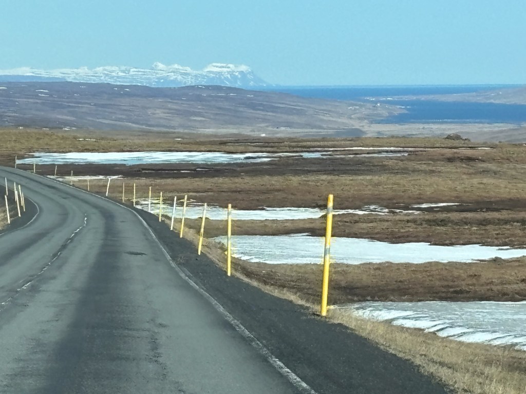
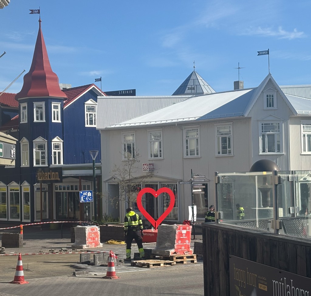
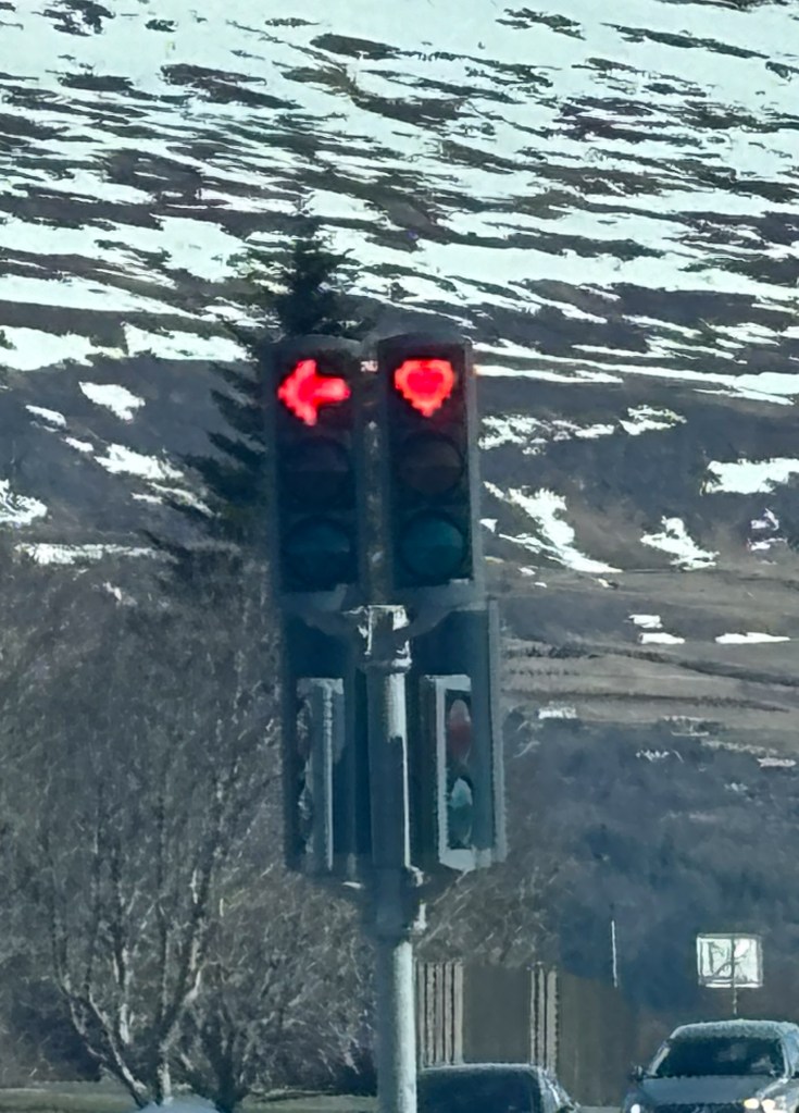
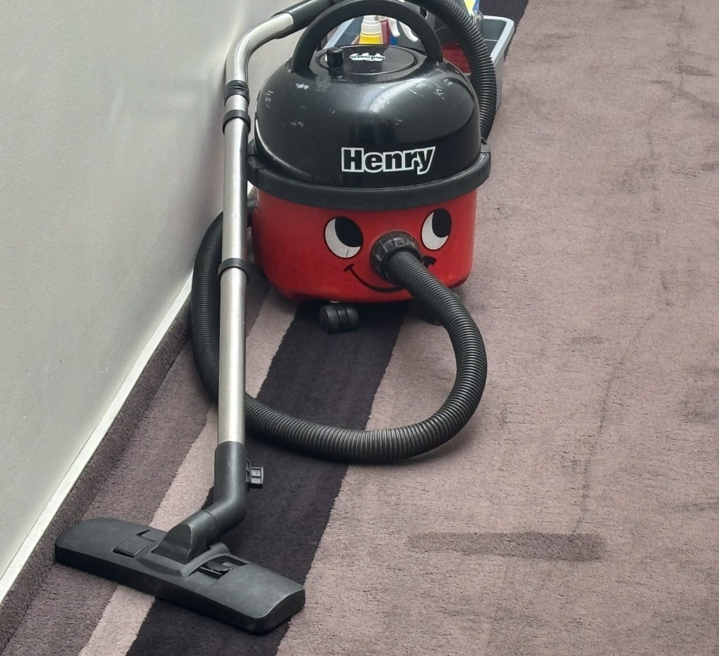
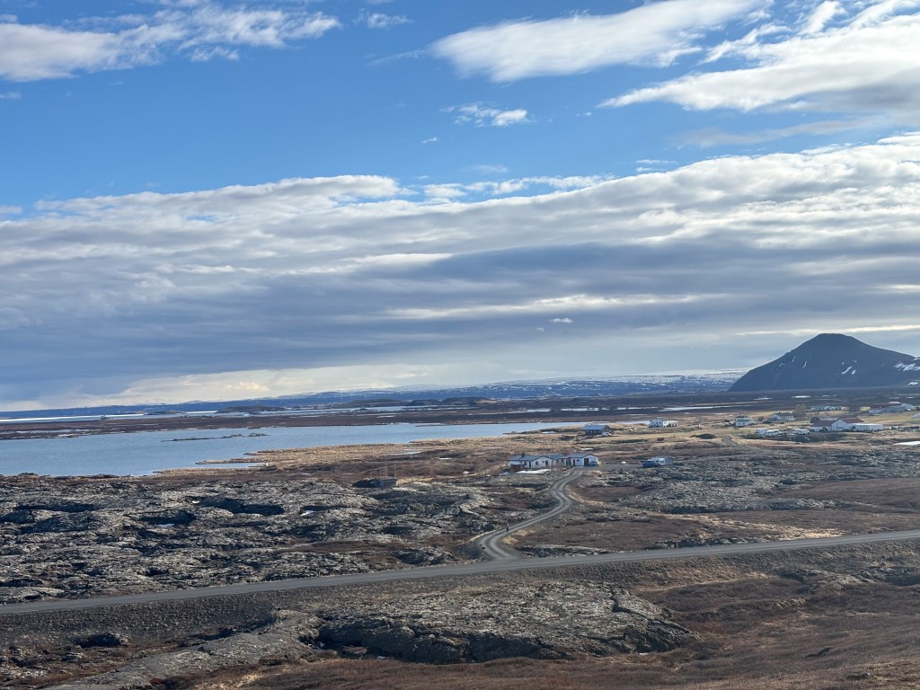
We stayed just one night a bit north of town to give us a head start on a longer travel day (3.5 hours) to Akureyri (AH-kuh-RAY-ree), the unofficial capital of North Ireland. On the way we drove over a pass that had higher snow poles than most places of the Ring Road (pictured below, which also shows what the 2-lane paved roadway looks like) and discovered several jagged peaks. Akureyri is right along the deep fjord called Eyjafjordur where fishing is the mainstay. I found this town of 18,000 people to be very light-hearted. Not only was there a wonderful red heart sculpture right across from our Kea Hotel, but the red in all its stoplights was in the form of a heart! Even the vacuum cleaner used by housekeeping also reflected the town’s joy!

Once again Gary was able to go on another private tour. He thought it was a photo tour (that’s what he signed up for), but the 2 guides who showed up were actually adventure guides. They knew lots of great places to take him for pictures but were not photographers. We didn’t know this when he took off…in this crazy looking jeep with crazy looking tires. In the photo below right, note the tube connecting the tire to the jeep. This allows the driver to adjust the pressure in the tires from the inside for the different terrains he’s traveling over.
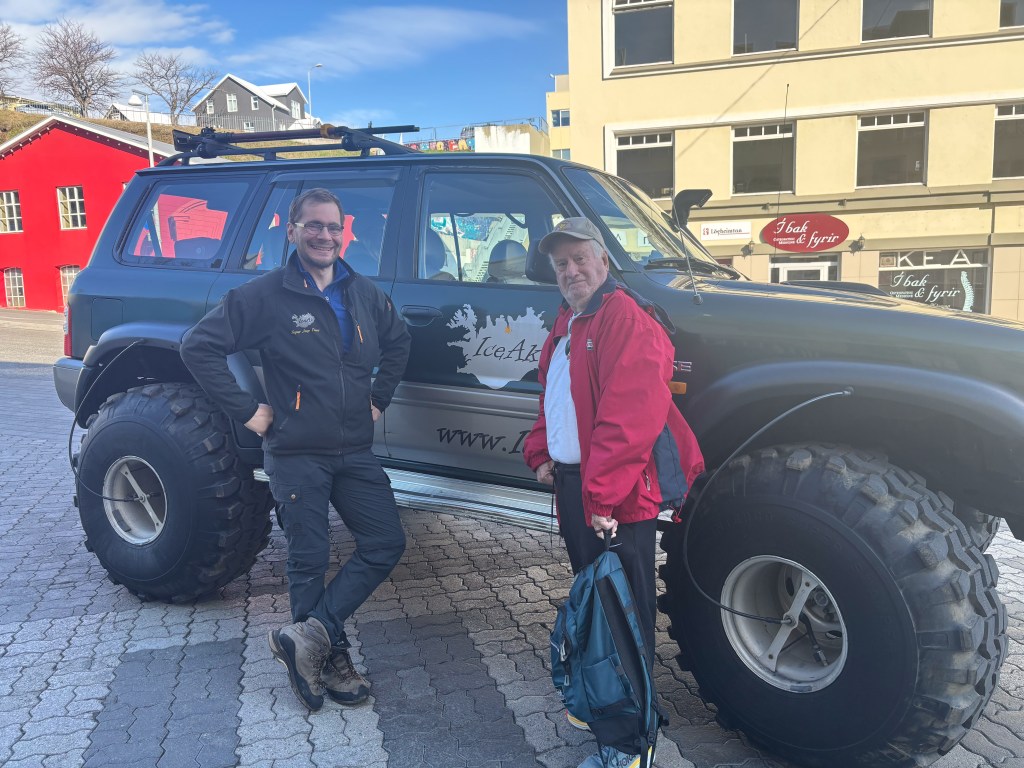

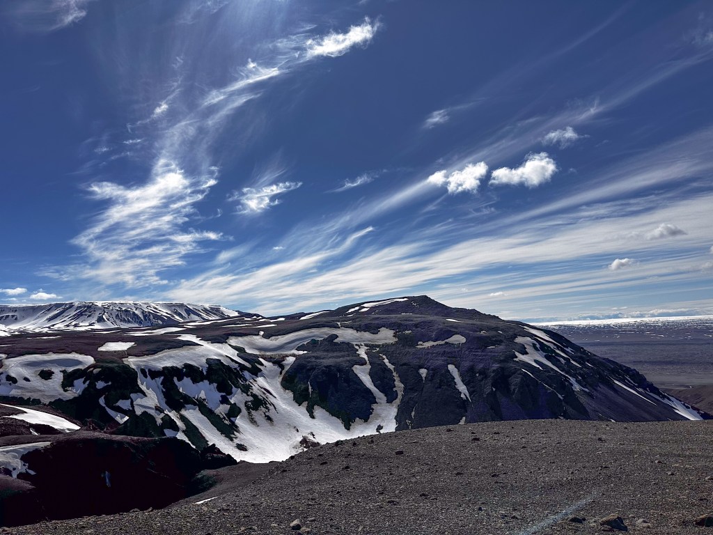
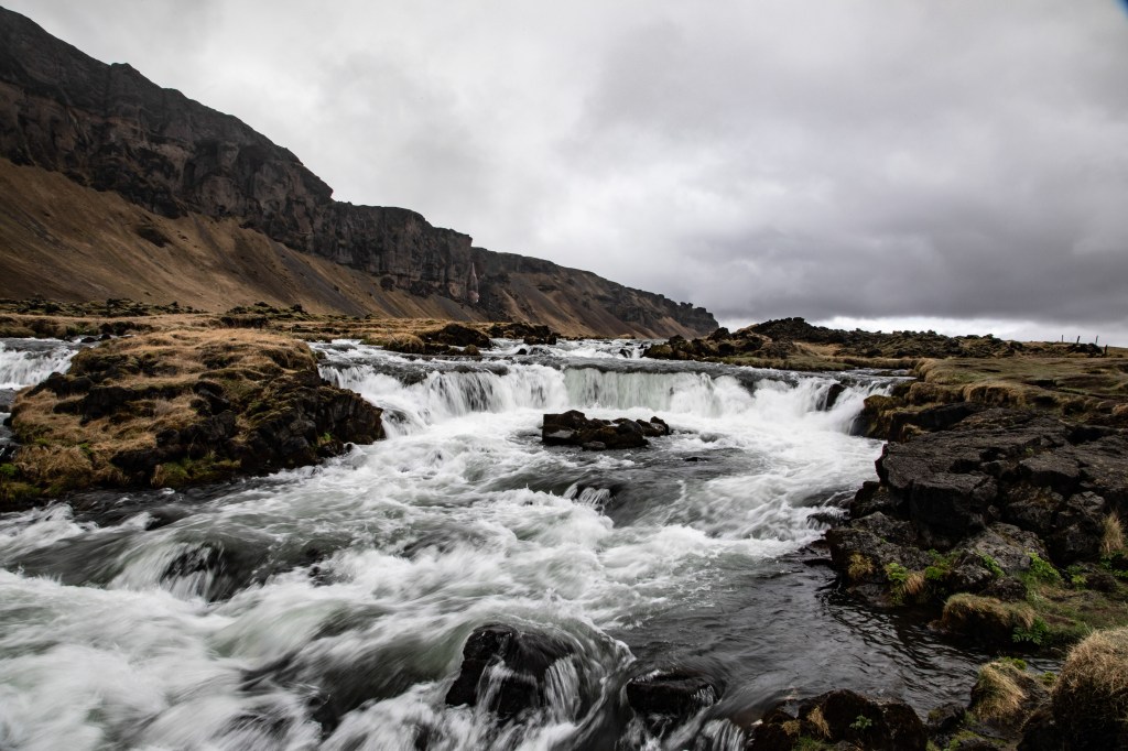
It turned out they really needed this feature because they ended up going into The Highlands, where only off-road vehicles (and no tourists) are allowed. (In fact, deeper into The Highlands and farther south is where NASA astronauts trained for the first moon landing!) Gary quickly adjusted to “adventure mode” and was thrilled to bump and roll through mud, slush, lava and rivers where anyone without experience would never be able to follow the “road.” If you click on each of the top 2 images below, you might enjoy bumping along with him and hearing hin laugh…or not!) It was amazing and, once again, he came back weary but exhilarated! One of the other highlights for him this day was taking photos of Godafoss, one of the most famous of all Iceland’s waterfalls. As you can see below, it is horseshoe-shaped; it is only 40’ high, but over 100 yards across.
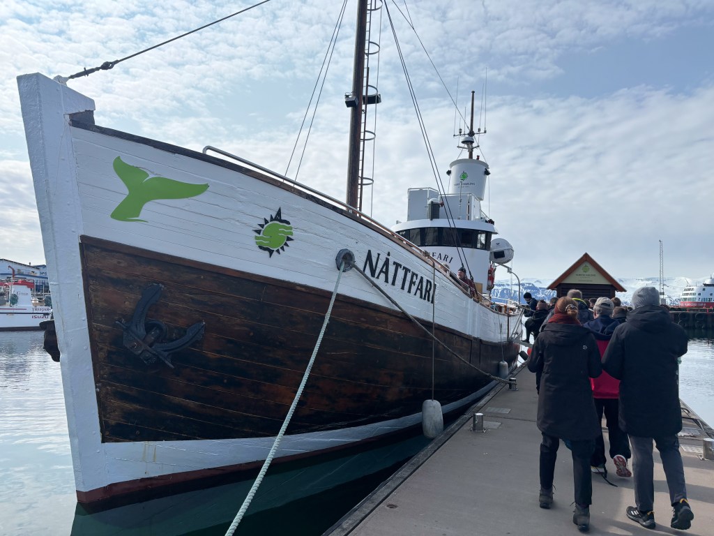
We stayed 2 nights in Akureyri (again, part of our pacing). As we headed northeast the next day, the road took us through the 7.5 kilometer (4.6 mile) Vadlaheidi Tunnel—the only one with a toll, and we had to pay online within 24 hours either before or after traveling through it. Our destination was “The Whale Watching Capital of Iceland,” Husavik (HOOS-ah-VEEK) where we went on a 3-hour whale watching adventure (complete with wind- and waterproof overalls!) in the Skjalfandi Bay, a part of the Greenland Sea, just 35 miles away from the Arctic Circle!! This is the farthest north we’ve ever been. Fortunately, it was a bright and sunny day, but coming back across the Bay late afternoon, it was quite chilly and both of us got drenched from the bow spray. It was definitely worth it though, because the scenery was amazing and we saw several humpback whales, some quite close to our boat—a big, sturdy old wooden boat—and a wonderful North Sailing crew who were marine biologists so we learned a lot about these remarkable mammals.

One of the reasons this area has so many whales is because there are far more nutrients in the water here, not only from plants, waterfalls and snowmelt, but also from the many daily earthquakes that release nutrients through the cracks in the ocean floor; when these reach the surface & daylight, the energy creates even richer nutrients for the whales AND the long, long daylight hours of spring & summer help create even more! (By the way, a 4,000-ton whale needs 1 ton of food per day!)


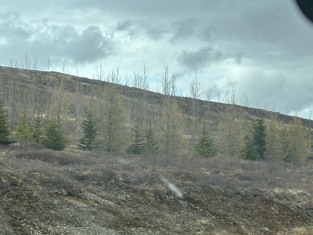
After whale watching, we had an easy drive to our next stop, Myvatn (MEE-vatn, n almost silent). Our wonderful Foss Hotel overlooked the volcanic Lake Myvatn. I took two pictures from the balcony in our room to show the panorama and sent them to my daughters (views from our room have become a part of our reporting to them as we go along), and Carolyn wrote back: “Kinda makes you miss a good tree.” Only then did we realize it had been several days since we’d seen any trees, and it was another 75 miles east of here before we finally came across a few small forests. After Carolyn’s text message, Gary and I laughed every time we looked out the windows of our hotel. We could see for miles in every direction, and, in the vastness, there were NO TREES!

We learned that when the Vikings arrived in the 900’s, there were so many trees along the coast where they settled that they had a hard time navigating through them. Land was cleared to create fields and pastures for the livestock they brought with them and to grow hay. Trees were cut not only to build houses but also for firewood to get residents through the long and bitter-cold winters. AND, volcanic activity through the centuries destroyed most of the rest. Currently, Iceland has relatively few trees, covering only 2% of the land, but there is a huge reforestation program in place whereby over 7 million trees are planted each year. There’s an Icelandic tree saying from pre-reforestation times that is often recited to tourists: “In Iceland if you see three trees together you have a forest.”
As we made our way across to the East, we began to see more and more real forests—primarily birch and spruce, some more mature than others—AND, there are still lots and lots of hugely vast spaces where there are no trees or forests at all—not even three trees together!

We’re still finding it hard to describe what we saw and experienced, but we’ll keep trying!
Away we go to Eastern Iceland (often called the Eastfjords) and beyond. Stay tuned!
